Brande-Hörnerkirchen geodata
Brande-Hörnerkirchen (Schleswig-Holstein) is a seat of a fourth-order administrative division; located in Germany in Europe/Berlin (GMT+2) time zone. With population of 1,606 people, there are 5673 cities with bigger population in this country. Compared to other cities in Germany, 90.6% of cities are located further ↓South; 54.2% of cities are located further →East and 95.6% of cities have higher elevation than Brande-Hörnerkirchen. Note1
Administrative division(s):
- Level 1: Schleswig-Holstein
- Level 3: Kreis Pinneberg
- Level 4: Brande-Hörnerkirchen


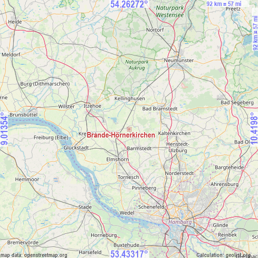
Brande-Hörnerkirchen GPS coordinates[2]
53° 51' 0" North, 9° 43' 0.012" East
| Map corner | latitude | longitude |
|---|---|---|
| Upper-left | 54.26272°, | 9.01354° |
| Center: | 53.85°, | 9.71667° |
| Lower-right: | 53.43317°, | 10.4198° |
| Map W x H: | 92.2×92.2 km | = 57.3×57.3mi |
| max Lat: | 55.01917° ⇑9.4% North |
| Brande-Hörnerkirchen: | 53.85° |
| min Lat: | ⇓90.6% South 47.40724° |
| min Long | Brande-Hörnerk | max Long |
| 5.92978° | 9.71667° | 14.98853° |
| W 45.8%⇐ | ⇒54.2% E |
Elevation
Elevation of Brande-Hörnerkirchen is 7 m = 23 ft, and this is 242.1 m = 794 ft below average elevation for this country.
| Max E: |
1256 m = 4121 ft | 95.6% |
| Avg. | 249.1 m = 817 ft | |
| Brande-Hörnerkirchen | 7 m = 23 ft | |
Min E: |
-5 m = -16 ft | 4.4% |
See also: Germany elevation on elevation.city.
Geographical zone
Brande-Hörnerkirchen is located in North temperate zone (between Tropic of Cancer and the Arctic Circle). Distance of this North polar circle is 1413.6 km =878.4 mi to North.| Distance of | km | miles | from Brande-Hörnerkirchen |
|---|---|---|---|
| North Pole | 4019.5 | 2497.6 | to North |
| Arctic Circle | 1413.6 | 878.4 | to North |
| Tropic Cancer | 3381.6 | 2101.2 | to South |
| Equator | 5987.6 | 3720.5 | to South |


Nearby cities:
15 places around Brande-Hörnerkirchen: (largest is in red/bold)
• Auufer
8.5 km =5.3 mi,  345°
345°
• Barmstedt
7.2 km =4.5 mi,  152°
152°
• Bokel
2.2 km =1.4 mi,  30°
30°
• Bokholt-Hanredder
7 km =4.3 mi,  169°
169°
• Groß Offenseth-Aspern
3.9 km =2.4 mi,  163°
163°
• Hingstheide
6 km =3.7 mi,  21°
21°
• Hohenfelde
6.2 km =3.9 mi,  263°
263°
• Horst
7.5 km =4.7 mi,  235°
235°
• Klein Offenseth-Sparrieshoop
6.2 km =3.9 mi,  198°
198°
• Lutzhorn
4.4 km =2.7 mi,  128°
128°
• Moordiek
8.2 km =5.1 mi,  329°
329°
• Mönkloh
6.5 km =4 mi,  46°
46°
• Osterhorn
2.2 km =1.4 mi, 329°
• Westerhorn
2.6 km =1.6 mi,  288°
288°
• Wulfsmoor
6.9 km =4.3 mi,  3°
3°
Sources, notices
• [Note1] Compared only with cities in Germany existing in our database
• [Src1] Map data: © OpenStreetMap contributors (CC-BY-SA)
• [Src2] Other city data from geonames.org with taken over terms of usage.
• [Src3] Geographical zone / Annual Mean Temperature by Robert A. Rohde @ Wikipedia
