Bokel geodata
Bokel (Schleswig-Holstein) is a seat of a fourth-order administrative division; located in Germany in Europe/Berlin (GMT+2) time zone. With population of 670 people, there are 8474 cities with bigger population in this country. Compared to other cities in Germany, 90.8% of cities are located further ↓South; 53.9% of cities are located further →East and 95.2% of cities have higher elevation than Bokel. Note1


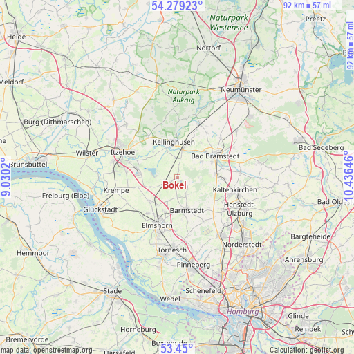
Bokel GPS coordinates[2]
53° 52' 0.012" North, 9° 43' 59.988" East
| Map corner | latitude | longitude |
|---|---|---|
| Upper-left | 54.27923°, | 9.0302° |
| Center: | 53.86667°, | 9.73333° |
| Lower-right: | 53.45°, | 10.43646° |
| Map W x H: | 92.2×92.2 km | = 57.3×57.3mi |
| max Lat: | 55.01917° ⇑9.2% North |
| Bokel: | 53.86667° |
| min Lat: | ⇓90.8% South 47.40724° |
| min Long | Bokel | max Long |
| 5.92978° | 9.73333° | 14.98853° |
| W 46.1%⇐ | ⇒53.9% E |
Elevation
Elevation of Bokel is 8 m = 26 ft, and this is 241.1 m = 791 ft below average elevation for this country.
| Max E: |
1256 m = 4121 ft | 95.2% |
| Avg. | 249.1 m = 817 ft | |
| Bokel | 8 m = 26 ft | |
Min E: |
-5 m = -16 ft | 4.8% |
See also: Germany elevation on elevation.city.
Geographical zone
Bokel is located in North temperate zone (between Tropic of Cancer and the Arctic Circle). Distance of this North polar circle is 1411.8 km =877.3 mi to North.| Distance of | km | miles | from Bokel |
|---|---|---|---|
| North Pole | 4017.6 | 2496.4 | to North |
| Arctic Circle | 1411.8 | 877.3 | to North |
| Tropic Cancer | 3383.5 | 2102.4 | to South |
| Equator | 5989.4 | 3721.6 | to South |


Nearby cities:
15 places around Bokel: (largest is in red/bold)
• Auufer
7.2 km =4.5 mi,  332°
332°
• Brande-Hörnerkirchen
2.2 km =1.4 mi,  210°
210°
• Föhrden-Barl
7.7 km =4.8 mi,  27°
27°
• Groß Offenseth-Aspern
5.6 km =3.5 mi,  180°
180°
• Hingstheide
3.9 km =2.4 mi,  16°
16°
• Hohenfelde
7.7 km =4.8 mi,  250°
250°
• Lutzhorn
5.2 km =3.2 mi,  153°
153°
• Moordiek
7.4 km =4.6 mi,  315°
315°
• Mönkloh
4.4 km =2.7 mi,  53°
53°
• Osterhorn
2.2 km =1.4 mi,  270°
270°
• Weddelbrook
7.5 km =4.7 mi,  60°
60°
• Westerhorn
3.7 km =2.3 mi, 253°
• Wittenbergen
8 km =5 mi,  337°
337°
• Wrist
7.7 km =4.8 mi, 16°
• Wulfsmoor
5.1 km =3.2 mi,  353°
353°
Sources, notices
• [Note1] Compared only with cities in Germany existing in our database
• [Src1] Map data: © OpenStreetMap contributors (CC-BY-SA)
• [Src2] Other city data from geonames.org with taken over terms of usage.
• [Src3] Geographical zone / Annual Mean Temperature by Robert A. Rohde @ Wikipedia
