Brahlstorf geodata
Brahlstorf (Mecklenburg-Vorpommern) is a populated place; located in Germany in Europe/Berlin (GMT+2) time zone. With population of 771 people, there are 8014 cities with bigger population in this country. Compared to other cities in Germany, 88.7% of cities are located further ↓South; 75.2% of cities are located further ←West and 83.7% of cities have higher elevation than Brahlstorf. Note1
Administrative division(s):
- Level 1: Mecklenburg-Vorpommern
- Level 3: Ludwigslust-Parchim
- Level 4: Cambs


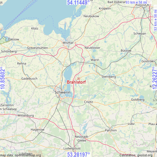
Brahlstorf GPS coordinates[2]
53° 42' 1.044" North, 11° 33' 32.904" East
| Map corner | latitude | longitude |
|---|---|---|
| Upper-left | 54.11449°, | 10.85602° |
| Center: | 53.70029°, | 11.55914° |
| Lower-right: | 53.28197°, | 12.26227° |
| Map W x H: | 92.6×92.6 km | = 57.5×57.5mi |
| max Lat: | 55.01917° ⇑11.3% North |
| Brahlstorf: | 53.70029° |
| min Lat: | ⇓88.7% South 47.40724° |
| min Long | Brahlstorf | max Long |
| 5.92978° | 11.55914° | 14.98853° |
| W 75.2%⇐ | ⇒24.8% E |
Elevation
Elevation of Brahlstorf is 38 m = 125 ft, and this is 211.1 m = 693 ft below average elevation for this country.
| Max E: |
1256 m = 4121 ft | 83.7% |
| Avg. | 249.1 m = 817 ft | |
| Brahlstorf | 38 m = 125 ft | |
Min E: |
-5 m = -16 ft | 16.3% |
See also: Germany elevation on elevation.city.
Geographical zone
Brahlstorf is located in North temperate zone (between Tropic of Cancer and the Arctic Circle). Distance of this North polar circle is 1430.3 km =888.7 mi to North.| Distance of | km | miles | from Brahlstorf |
|---|---|---|---|
| North Pole | 4036.1 | 2507.9 | to North |
| Arctic Circle | 1430.3 | 888.7 | to North |
| Tropic Cancer | 3365 | 2090.9 | to South |
| Equator | 5970.9 | 3710.1 | to South |


Nearby cities:
15 places around Brahlstorf: (largest is in red/bold)
• Bad Kleinen
9.8 km =6.1 mi,  323°
323°
• Brüel
11 km =6.8 mi,  68°
68°
• Cambs
2.1 km =1.3 mi,  260°
260°
• Hohen Viecheln
9.9 km =6.2 mi,  341°
341°
• Kuhlen
4.2 km =2.6 mi,  56°
56°
• Leezen
5.8 km =3.6 mi,  223°
223°
• Lübstorf
9.9 km =6.2 mi,  286°
286°
• Pinnow
11 km =6.8 mi,  184°
184°
• Raben Steinfeld
11.6 km =7.2 mi,  198°
198°
• Retgendorf
4.9 km =3 mi,  311°
311°
• Rubow
6.3 km =3.9 mi,  7°
7°
• Seehof
8.4 km =5.2 mi, 264°
• Ventschow
9.8 km =6.1 mi, 8°
• Werdervorstadt
11 km =6.8 mi,  231°
231°
• Zickhusen
11.6 km =7.2 mi,  304°
304°
Sources, notices
• [Note1] Compared only with cities in Germany existing in our database
• [Src1] Map data: © OpenStreetMap contributors (CC-BY-SA)
• [Src2] Other city data from geonames.org with taken over terms of usage.
• [Src3] Geographical zone / Annual Mean Temperature by Robert A. Rohde @ Wikipedia
