Brüel geodata
Brüel (Mecklenburg-Vorpommern) is a populated place; located in Germany in Europe/Berlin (GMT+2) time zone. With population of 3,140 people, there are 3878 cities with bigger population in this country. Compared to other cities in Germany, 89.2% of cities are located further ↓South; 77.4% of cities are located further ←West and 91.2% of cities have higher elevation than Brüel. Note1
Administrative division(s):
- Level 1: Mecklenburg-Vorpommern
- Level 3: Ludwigslust-Parchim
- Level 4: Brüel


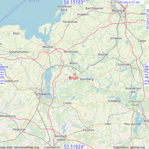
Brüel GPS coordinates[2]
53° 44' 13.884" North, 11° 42' 52.956" East
| Map corner | latitude | longitude |
|---|---|---|
| Upper-left | 54.15103°, | 11.01159° |
| Center: | 53.73719°, | 11.71471° |
| Lower-right: | 53.31924°, | 12.41784° |
| Map W x H: | 92.5×92.5 km | = 57.5×57.5mi |
| max Lat: | 55.01917° ⇑10.8% North |
| Brüel: | 53.73719° |
| min Lat: | ⇓89.2% South 47.40724° |
| min Long | Brüel | max Long |
| 5.92978° | 11.71471° | 14.98853° |
| W 77.4%⇐ | ⇒22.6% E |
Elevation
Elevation of Brüel is 18 m = 59 ft, and this is 231.1 m = 758 ft below average elevation for this country.
| Max E: |
1256 m = 4121 ft | 91.2% |
| Avg. | 249.1 m = 817 ft | |
| Brüel | 18 m = 59 ft | |
Min E: |
-5 m = -16 ft | 8.8% |
See also: Germany elevation on elevation.city.
Geographical zone
Brüel is located in North temperate zone (between Tropic of Cancer and the Arctic Circle). Distance of this North polar circle is 1426.2 km =886.2 mi to North.| Distance of | km | miles | from Brüel |
|---|---|---|---|
| North Pole | 4032 | 2505.4 | to North |
| Arctic Circle | 1426.2 | 886.2 | to North |
| Tropic Cancer | 3369.1 | 2093.5 | to South |
| Equator | 5975 | 3712.7 | to South |


Nearby cities:
15 places around Brüel: (largest is in red/bold)
• Brahlstorf
11 km =6.8 mi,  248°
248°
• Cambs
13.1 km =8.1 mi, 250°
• Demen
12.4 km =7.7 mi,  164°
164°
• Gägelow
13.3 km =8.3 mi,  115°
115°
• Hohen Viecheln
14.4 km =8.9 mi,  291°
291°
• Jesendorf
10.5 km =6.5 mi,  314°
314°
• Kuhlen
7 km =4.3 mi, 254°
• Neukloster
14.4 km =8.9 mi,  352°
352°
• Retgendorf
13.9 km =8.6 mi,  266°
266°
• Rubow
9.7 km =6 mi,  283°
283°
• Sternberg
7.9 km =4.9 mi,  110°
110°
• Ventschow
10.5 km =6.5 mi,  302°
302°
• Warin
7 km =4.3 mi, 354°
• Warnow
12.2 km =7.6 mi,  63°
63°
• Witzin
13.7 km =8.5 mi,  96°
96°
Sources, notices
• [Note1] Compared only with cities in Germany existing in our database
• [Src1] Map data: © OpenStreetMap contributors (CC-BY-SA)
• [Src2] Other city data from geonames.org with taken over terms of usage.
• [Src3] Geographical zone / Annual Mean Temperature by Robert A. Rohde @ Wikipedia
