Bönningstedt geodata
Bönningstedt (Schleswig-Holstein) is a seat of a fourth-order administrative division; located in Germany in Europe/Berlin (GMT+2) time zone. With population of 3,903 people, there are 3349 cities with bigger population in this country. Compared to other cities in Germany, 88% of cities are located further ↓South; 51.3% of cities are located further →East and 93.1% of cities have higher elevation than Bönningstedt. Note1
Administrative division(s):
- Level 1: Schleswig-Holstein
- Level 3: Kreis Pinneberg
- Level 4: Bönningstedt


Bönningstedt GPS coordinates[2]
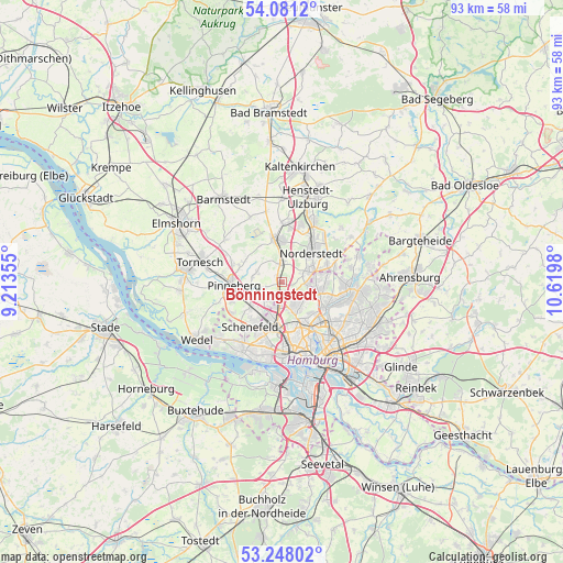
53° 40' 0.012" North, 9° 55' 0.012" East
| Map corner | latitude | longitude |
|---|---|---|
| Upper-left | 54.0812°, | 9.21355° |
| Center: | 53.66667°, | 9.91667° |
| Lower-right: | 53.24802°, | 10.6198° |
| Map W x H: | 92.6×92.6 km | = 57.5×57.5mi |
| max Lat: | 55.01917° ⇑12% North |
| Bönningstedt: | 53.66667° |
| min Lat: | ⇓88% South 47.40724° |
| min Long | Bönningstedt | max Long |
| 5.92978° | 9.91667° | 14.98853° |
| W 48.7%⇐ | ⇒51.3% E |
Elevation
Elevation of Bönningstedt is 13 m = 43 ft, and this is 236.1 m = 775 ft below average elevation for this country.
| Max E: |
1256 m = 4121 ft | 93.1% |
| Avg. | 249.1 m = 817 ft | |
| Bönningstedt | 13 m = 43 ft | |
Min E: |
-5 m = -16 ft | 6.9% |
See also: Germany elevation on elevation.city.
Geographical zone
Bönningstedt is located in North temperate zone (between Tropic of Cancer and the Arctic Circle). Distance of this North polar circle is 1434 km =891 mi to North.| Distance of | km | miles | from Bönningstedt |
|---|---|---|---|
| North Pole | 4039.9 | 2510.3 | to North |
| Arctic Circle | 1434 | 891 | to North |
| Tropic Cancer | 3361.3 | 2088.6 | to South |
| Equator | 5967.2 | 3707.8 | to South |


Nearby cities:
15 places around Bönningstedt: (largest is in red/bold)
• Borstel-Hohenraden
6.8 km =4.2 mi,  285°
285°
• Eidelstedt
6.7 km =4.2 mi,  186°
186°
• Ellerbek
3.2 km =2 mi,  252°
252°
• Fuhlsbüttel
7.5 km =4.7 mi,  118°
118°
• Halstenbek
5.7 km =3.5 mi,  229°
229°
• Hasloh
3.1 km =1.9 mi,  0°
0°
• Hummelsbüttel
8.5 km =5.3 mi,  104°
104°
• Langenhorn
6.6 km =4.1 mi,  90°
90°
• Lurup
8.6 km =5.3 mi,  197°
197°
• Norderstedt
4.7 km =2.9 mi,  63°
63°
• Pinneberg
8.4 km =5.2 mi,  270°
270°
• Quickborn
6.9 km =4.3 mi,  355°
355°
• Rellingen
6.8 km =4.2 mi, 254°
• Stellingen
8.3 km =5.2 mi,  174°
174°
• Tangstedt
4.6 km =2.9 mi,  284°
284°
Sources, notices
• [Note1] Compared only with cities in Germany existing in our database
• [Src1] Map data: © OpenStreetMap contributors (CC-BY-SA)
• [Src2] Other city data from geonames.org with taken over terms of usage.
• [Src3] Geographical zone / Annual Mean Temperature by Robert A. Rohde @ Wikipedia
