Bönebüttel geodata
Bönebüttel (Schleswig-Holstein) is a seat of a fourth-order administrative division; located in Germany in Europe/Berlin (GMT+2) time zone. With population of 2,049 people, there are 4998 cities with bigger population in this country. Compared to other cities in Germany, 93.7% of cities are located further ↓South; 51.1% of cities are located further ←West and 88.3% of cities have higher elevation than Bönebüttel. Note1


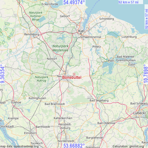
Bönebüttel GPS coordinates[2]
54° 4' 59.988" North, 10° 4' 0.012" East
| Map corner | latitude | longitude |
|---|---|---|
| Upper-left | 54.49374°, | 9.36354° |
| Center: | 54.08333°, | 10.06667° |
| Lower-right: | 53.66882°, | 10.7698° |
| Map W x H: | 91.7×91.7 km | = 57×57mi |
| max Lat: | 55.01917° ⇑6.3% North |
| Bönebüttel: | 54.08333° |
| min Lat: | ⇓93.7% South 47.40724° |
| min Long | Bönebüttel | max Long |
| 5.92978° | 10.06667° | 14.98853° |
| W 51.1%⇐ | ⇒48.9% E |
Elevation
Elevation of Bönebüttel is 26 m = 85 ft, and this is 223.1 m = 732 ft below average elevation for this country.
| Max E: |
1256 m = 4121 ft | 88.3% |
| Avg. | 249.1 m = 817 ft | |
| Bönebüttel | 26 m = 85 ft | |
Min E: |
-5 m = -16 ft | 11.7% |
See also: Germany elevation on elevation.city.
Geographical zone
Bönebüttel is located in North temperate zone (between Tropic of Cancer and the Arctic Circle). Distance of this North polar circle is 1387.7 km =862.3 mi to North.| Distance of | km | miles | from Bönebüttel |
|---|---|---|---|
| North Pole | 3993.6 | 2481.5 | to North |
| Arctic Circle | 1387.7 | 862.3 | to North |
| Tropic Cancer | 3407.6 | 2117.4 | to South |
| Equator | 6013.5 | 3736.6 | to South |


Nearby cities:
15 places around Bönebüttel: (largest is in red/bold)
• Boostedt
7.7 km =4.8 mi,  196°
196°
• Busdorf
2.5 km =1.6 mi,  24°
24°
• Groß Buchwald
9.3 km =5.8 mi,  6°
6°
• Groß Kummerfeld
3.9 km =2.4 mi,  163°
163°
• Großharrie
3.9 km =2.4 mi,  343°
343°
• Gönnebek
9.3 km =5.8 mi,  114°
114°
• Latendorf
9.3 km =5.8 mi,  180°
180°
• Mühbrook
8.9 km =5.5 mi, 336°
• Negenharrie
6.6 km =4.1 mi,  4°
4°
• Neumünster
5.6 km =3.5 mi,  260°
260°
• Rendswühren
7.6 km =4.7 mi,  90°
90°
• Schillsdorf
5.7 km =3.5 mi,  49°
49°
• Tasdorf
2.9 km =1.8 mi,  310°
310°
• Wankendorf
9.6 km =6 mi,  70°
70°
• Wattenbek
9.3 km =5.8 mi,  353°
353°
Sources, notices
• [Note1] Compared only with cities in Germany existing in our database
• [Src1] Map data: © OpenStreetMap contributors (CC-BY-SA)
• [Src2] Other city data from geonames.org with taken over terms of usage.
• [Src3] Geographical zone / Annual Mean Temperature by Robert A. Rohde @ Wikipedia
