Blaufelden geodata
Blaufelden (Baden-Württemberg) is a seat of a fourth-order administrative division; located in Germany in Europe/Berlin (GMT+2) time zone. With population of 5,348 people, there are 2681 cities with bigger population in this country. Compared to other cities in Germany, 78.7% of cities are located further ↑North; 50.4% of cities are located further →East and 84.1% of cities have lower elevation than Blaufelden. Note1
Administrative division(s):
- Level 1: Baden-Württemberg
- Level 2: Regierungsbezirk Stuttgart
- Level 3: Landkreis Schwäbisch Hall
- Level 4: Blaufelden


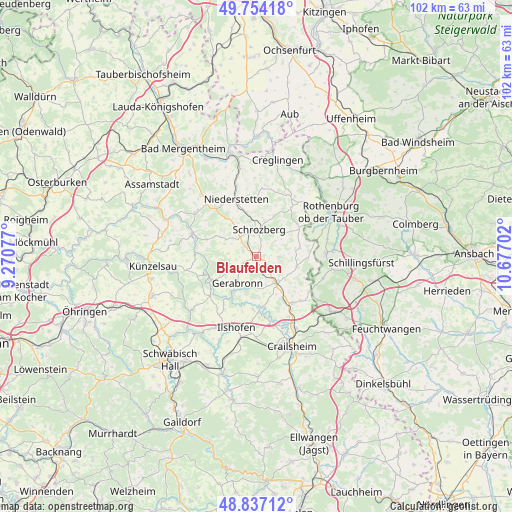
Blaufelden GPS coordinates[2]
49° 17' 52.008" North, 9° 58' 26.004" East
| Map corner | latitude | longitude |
|---|---|---|
| Upper-left | 49.75418°, | 9.27077° |
| Center: | 49.29778°, | 9.97389° |
| Lower-right: | 48.83712°, | 10.67702° |
| Map W x H: | 102×102 km | = 63.4×63.4mi |
| max Lat: | 55.01917° ⇑78.7% North |
| Blaufelden: | 49.29778° |
| min Lat: | ⇓21.3% South 47.40724° |
| min Long | Blaufelden | max Long |
| 5.92978° | 9.97389° | 14.98853° |
| W 49.6%⇐ | ⇒50.4% E |
Elevation
Elevation of Blaufelden is 462 m = 1516 ft, and this is 212.9 m = 698 ft above average elevation for this country.
| Max E: |
1256 m = 4121 ft | 15.9% |
| Blaufelden | 462 m 1516 ft | |
| Avg. | 249.1 m = 817 ft | |
Min E: |
-5 m = -16 ft | 84.1% |
See also: Germany elevation on elevation.city.
Geographical zone
Blaufelden is located in North temperate zone (between Tropic of Cancer and the Arctic Circle). Distance of this North polar circle is 1919.8 km =1192.9 mi to North.| Distance of | km | miles | from Blaufelden |
|---|---|---|---|
| North Pole | 4525.7 | 2812.1 | to North |
| Arctic Circle | 1919.8 | 1192.9 | to North |
| Tropic Cancer | 2875.5 | 1786.8 | to South |
| Equator | 5481.4 | 3406 | to South |


Nearby cities:
15 places around Blaufelden: (largest is in red/bold)
• Braunsbach
17.2 km =10.7 mi,  230°
230°
• Diebach
15.9 km =9.9 mi,  85°
85°
• Gebsattel
17.4 km =10.8 mi,  70°
70°
• Ilshofen
14.8 km =9.2 mi,  195°
195°
• Insingen
14 km =8.7 mi, 88°
• Kirchberg an der Jagst
10.8 km =6.7 mi,  176°
176°
• Langenburg
9.8 km =6.1 mi,  240°
240°
• Mulfingen
13.4 km =8.3 mi,  290°
290°
• Niederstetten
12 km =7.5 mi,  340°
340°
• Rot am See
6.2 km =3.9 mi,  149°
149°
• Satteldorf
16.2 km =10.1 mi, 151°
• Schrozberg
5.3 km =3.3 mi,  4°
4°
• Wallhausen
11.6 km =7.2 mi, 146°
• Wettringen
14 km =8.7 mi,  108°
108°
• Wolpertshausen
17.3 km =10.7 mi,  212°
212°
Sources, notices
• [Note1] Compared only with cities in Germany existing in our database
• [Src1] Map data: © OpenStreetMap contributors (CC-BY-SA)
• [Src2] Other city data from geonames.org with taken over terms of usage.
• [Src3] Geographical zone / Annual Mean Temperature by Robert A. Rohde @ Wikipedia
