Bindlach geodata
Bindlach (Bavaria) is a seat of a fourth-order administrative division; located in Germany in Europe/Berlin (GMT+2) time zone. With population of 7,229 people, there are 2133 cities with bigger population in this country. Compared to other cities in Germany, 64.3% of cities are located further ↑North; 75.9% of cities are located further ←West and 70.3% of cities have lower elevation than Bindlach. Note1
Administrative division(s):
- Level 1: Bavaria
- Level 2: Upper Franconia
- Level 3: Landkreis Bayreuth
- Level 4: Bindlach


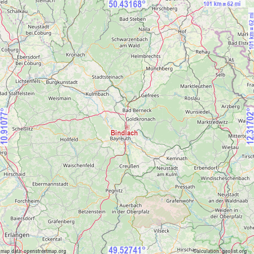
Bindlach GPS coordinates[2]
49° 58' 54.012" North, 11° 36' 50.004" East
| Map corner | latitude | longitude |
|---|---|---|
| Upper-left | 50.43168°, | 10.91077° |
| Center: | 49.98167°, | 11.61389° |
| Lower-right: | 49.52741°, | 12.31702° |
| Map W x H: | 100.5×100.5 km | = 62.4×62.4mi |
| max Lat: | 55.01917° ⇑64.3% North |
| Bindlach: | 49.98167° |
| min Lat: | ⇓35.7% South 47.40724° |
| min Long | Bindlach | max Long |
| 5.92978° | 11.61389° | 14.98853° |
| W 75.9%⇐ | ⇒24.1% E |
Elevation
Elevation of Bindlach is 360 m = 1181 ft, and this is 110.9 m = 364 ft above average elevation for this country.
| Max E: |
1256 m = 4121 ft | 29.7% |
| Bindlach | 360 m 1181 ft | |
| Avg. | 249.1 m = 817 ft | |
Min E: |
-5 m = -16 ft | 70.3% |
See also: Germany elevation on elevation.city.
Geographical zone
Bindlach is located in North temperate zone (between Tropic of Cancer and the Arctic Circle). Distance of this North polar circle is 1843.7 km =1145.6 mi to North.| Distance of | km | miles | from Bindlach |
|---|---|---|---|
| North Pole | 4449.6 | 2764.9 | to North |
| Arctic Circle | 1843.7 | 1145.6 | to North |
| Tropic Cancer | 2951.5 | 1834 | to South |
| Equator | 5557.4 | 3453.2 | to South |


Nearby cities:
15 places around Bindlach: (largest is in red/bold)
• Bad Berneck im Fichtelgebirge
8.2 km =5.1 mi,  30°
30°
• Bayreuth
4.5 km =2.8 mi,  213°
213°
• Eckersdorf
9.9 km =6.2 mi,  238°
238°
• Emtmannsberg
10.2 km =6.3 mi,  167°
167°
• Gesees
6.7 km =4.2 mi, 33°
• Gesees
10.8 km =6.7 mi, 212°
• Goldkronach
6.2 km =3.9 mi,  58°
58°
• Harsdorf
6.7 km =4.2 mi,  329°
329°
• Heinersreuth
6 km =3.7 mi,  253°
253°
• Himmelkron
9.5 km =5.9 mi,  354°
354°
• Mistelbach
10.6 km =6.6 mi,  223°
223°
• Neudrossenfeld
9 km =5.6 mi,  295°
295°
• Neunkirchen am Main
7 km =4.3 mi,  159°
159°
• Reuth
5.9 km =3.7 mi,  80°
80°
• Trebgast
10.5 km =6.5 mi, 334°
Sources, notices
• [Note1] Compared only with cities in Germany existing in our database
• [Src1] Map data: © OpenStreetMap contributors (CC-BY-SA)
• [Src2] Other city data from geonames.org with taken over terms of usage.
• [Src3] Geographical zone / Annual Mean Temperature by Robert A. Rohde @ Wikipedia
