Heinersreuth geodata
Heinersreuth (Bavaria) is a seat of a fourth-order administrative division; located in Germany in Europe/Berlin (GMT+2) time zone. In our database, there are 11009 cities with bigger population. Compared to other cities in Germany, 64.8% of cities are located further ↑North; 74.7% of cities are located further ←West and 67.1% of cities have lower elevation than Heinersreuth. Note1
Administrative division(s):
- Level 1: Bavaria
- Level 2: Upper Franconia
- Level 3: Landkreis Bayreuth
- Level 4: Heinersreuth


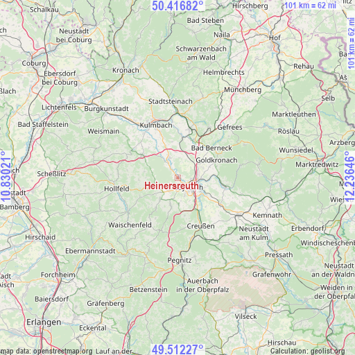
Heinersreuth GPS coordinates[2]
49° 58' 0.012" North, 11° 31' 59.988" East
| Map corner | latitude | longitude |
|---|---|---|
| Upper-left | 50.41682°, | 10.83021° |
| Center: | 49.96667°, | 11.53333° |
| Lower-right: | 49.51227°, | 12.23646° |
| Map W x H: | 100.6×100.6 km | = 62.5×62.5mi |
| max Lat: | 55.01917° ⇑64.8% North |
| Heinersreuth: | 49.96667° |
| min Lat: | ⇓35.2% South 47.40724° |
| min Long | Heinersreuth | max Long |
| 5.92978° | 11.53333° | 14.98853° |
| W 74.7%⇐ | ⇒25.3% E |
Elevation
Elevation of Heinersreuth is 336 m = 1102 ft, and this is 86.9 m = 285 ft above average elevation for this country.
| Max E: |
1256 m = 4121 ft | 32.9% |
| Heinersreuth | 336 m 1102 ft | |
| Avg. | 249.1 m = 817 ft | |
Min E: |
-5 m = -16 ft | 67.1% |
See also: Germany elevation on elevation.city.
Geographical zone
Heinersreuth is located in North temperate zone (between Tropic of Cancer and the Arctic Circle). Distance of this North polar circle is 1845.4 km =1146.7 mi to North.| Distance of | km | miles | from Heinersreuth |
|---|---|---|---|
| North Pole | 4451.3 | 2765.9 | to North |
| Arctic Circle | 1845.4 | 1146.7 | to North |
| Tropic Cancer | 2949.9 | 1833 | to South |
| Equator | 5555.8 | 3452.2 | to South |


Nearby cities:
15 places around Heinersreuth: (largest is in red/bold)
• Bayreuth
3.9 km =2.4 mi,  122°
122°
• Bindlach
6 km =3.7 mi,  73°
73°
• Eckersdorf
4.4 km =2.7 mi,  216°
216°
• Emtmannsberg
11.5 km =7.1 mi,  136°
136°
• Gesees
7.4 km =4.6 mi,  180°
180°
• Glashütten
10.7 km =6.6 mi,  214°
214°
• Haag
10.9 km =6.8 mi,  169°
169°
• Harsdorf
7.8 km =4.8 mi,  17°
17°
• Mistelbach
6.2 km =3.9 mi,  193°
193°
• Mistelgau
7.7 km =4.8 mi, 218°
• Neudrossenfeld
6 km =3.7 mi,  336°
336°
• Neunkirchen am Main
9.5 km =5.9 mi, 120°
• Reuth
11.8 km =7.3 mi,  77°
77°
• Thurnau
11.9 km =7.4 mi,  303°
303°
• Trebgast
11.2 km =7 mi,  6°
6°
Sources, notices
• [Note1] Compared only with cities in Germany existing in our database
• [Src1] Map data: © OpenStreetMap contributors (CC-BY-SA)
• [Src2] Other city data from geonames.org with taken over terms of usage.
• [Src3] Geographical zone / Annual Mean Temperature by Robert A. Rohde @ Wikipedia
