Bietigheim geodata
Bietigheim (Baden-Württemberg) is a seat of a fourth-order administrative division; located in Germany in Europe/Berlin (GMT+2) time zone. With population of 6,026 people, there are 2452 cities with bigger population in this country. Compared to other cities in Germany, 84% of cities are located further ↑North; 73.5% of cities are located further →East and 65.2% of cities have higher elevation than Bietigheim. Note1
Administrative division(s):
- Level 1: Baden-Württemberg
- Level 2: Karlsruhe Region
- Level 3: Landkreis Rastatt
- Level 4: Bietigheim


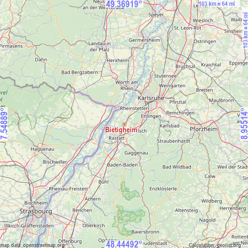
Bietigheim GPS coordinates[2]
48° 54' 33.084" North, 8° 15' 7.272" East
| Map corner | latitude | longitude |
|---|---|---|
| Upper-left | 49.36919°, | 7.54889° |
| Center: | 48.90919°, | 8.25202° |
| Lower-right: | 48.44492°, | 8.95514° |
| Map W x H: | 102.8×102.8 km | = 63.9×63.9mi |
| max Lat: | 55.01917° ⇑84% North |
| Bietigheim: | 48.90919° |
| min Lat: | ⇓16% South 47.40724° |
| min Long | Bietigheim | max Long |
| 5.92978° | 8.25202° | 14.98853° |
| W 26.5%⇐ | ⇒73.5% E |
Elevation
Elevation of Bietigheim is 119 m = 390 ft, and this is 130.1 m = 427 ft below average elevation for this country.
| Max E: |
1256 m = 4121 ft | 65.2% |
| Avg. | 249.1 m = 817 ft | |
| Bietigheim | 119 m = 390 ft | |
Min E: |
-5 m = -16 ft | 34.8% |
See also: Germany elevation on elevation.city.
Geographical zone
Bietigheim is located in North temperate zone (between Tropic of Cancer and the Arctic Circle). Distance of this North polar circle is 1963 km =1219.8 mi to North.| Distance of | km | miles | from Bietigheim |
|---|---|---|---|
| North Pole | 4568.9 | 2839 | to North |
| Arctic Circle | 1963 | 1219.8 | to North |
| Tropic Cancer | 2832.3 | 1759.9 | to South |
| Equator | 5438.2 | 3379.1 | to South |


Nearby cities:
15 places around Bietigheim: (largest is in red/bold)
• Au am Rhein
4.7 km =2.9 mi,  343°
343°
• Berg
9.1 km =5.7 mi, 336°
• Bischweier
8.3 km =5.2 mi,  163°
163°
• Durmersheim
2.9 km =1.8 mi,  21°
21°
• Ettlingen
11.9 km =7.4 mi,  72°
72°
• Kuppenheim
9 km =5.6 mi,  179°
179°
• Malsch
6.6 km =4.1 mi,  115°
115°
• Muggensturm
5.3 km =3.3 mi,  154°
154°
• Neuburg
8.9 km =5.5 mi,  357°
357°
• Rastatt
6.4 km =4 mi,  208°
208°
• Rheinau
6.1 km =3.8 mi,  226°
226°
• Rheinstetten
7.7 km =4.8 mi,  31°
31°
• Scheibenhardt
11.4 km =7.1 mi,  314°
314°
• Steinmauern
4.1 km =2.5 mi,  257°
257°
• Ötigheim
2.4 km =1.5 mi, 212°
Sources, notices
• [Note1] Compared only with cities in Germany existing in our database
• [Src1] Map data: © OpenStreetMap contributors (CC-BY-SA)
• [Src2] Other city data from geonames.org with taken over terms of usage.
• [Src3] Geographical zone / Annual Mean Temperature by Robert A. Rohde @ Wikipedia
