Neuburg geodata
Neuburg (Rheinland-Pfalz) is a populated place; located in Germany in Europe/Berlin (GMT+2) time zone. With population of 2,549 people, there are 4380 cities with bigger population in this country. Compared to other cities in Germany, 83.1% of cities are located further ↑North; 73.5% of cities are located further →East and 66.7% of cities have higher elevation than Neuburg. Note1
Administrative division(s):
- Level 1: Rheinland-Pfalz
- Level 3: Landkreis Germersheim
- Level 4: Neuburg am Rhein


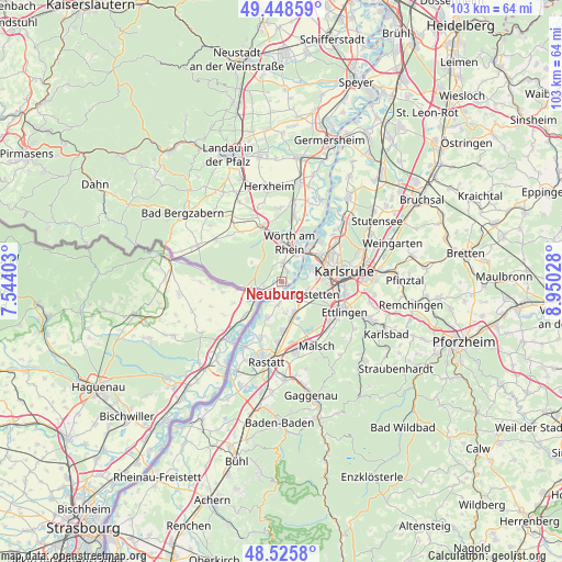
Neuburg GPS coordinates[2]
48° 59' 21.588" North, 8° 14' 49.74" East
| Map corner | latitude | longitude |
|---|---|---|
| Upper-left | 49.44859°, | 7.54403° |
| Center: | 48.98933°, | 8.24715° |
| Lower-right: | 48.5258°, | 8.95028° |
| Map W x H: | 102.6×102.6 km | = 63.8×63.8mi |
| max Lat: | 55.01917° ⇑83.1% North |
| Neuburg: | 48.98933° |
| min Lat: | ⇓16.9% South 47.40724° |
| min Long | Neuburg | max Long |
| 5.92978° | 8.24715° | 14.98853° |
| W 26.5%⇐ | ⇒73.5% E |
Elevation
Elevation of Neuburg is 110 m = 361 ft, and this is 139.1 m = 456 ft below average elevation for this country.
| Max E: |
1256 m = 4121 ft | 66.7% |
| Avg. | 249.1 m = 817 ft | |
| Neuburg | 110 m = 361 ft | |
Min E: |
-5 m = -16 ft | 33.3% |
See also: Germany elevation on elevation.city.
Geographical zone
Neuburg is located in North temperate zone (between Tropic of Cancer and the Arctic Circle). Distance of this North polar circle is 1954.1 km =1214.2 mi to North.| Distance of | km | miles | from Neuburg |
|---|---|---|---|
| North Pole | 4560 | 2833.5 | to North |
| Arctic Circle | 1954.1 | 1214.2 | to North |
| Tropic Cancer | 2841.2 | 1765.4 | to South |
| Equator | 5447.1 | 3384.7 | to South |


Nearby cities:
15 places around Neuburg: (largest is in red/bold)
• Au am Rhein
4.5 km =2.8 mi,  192°
192°
• Berg
3.3 km =2.1 mi,  259°
259°
• Bietigheim
8.9 km =5.5 mi,  177°
177°
• Durmersheim
6.4 km =4 mi,  167°
167°
• Ettlingen
12.9 km =8 mi,  114°
114°
• Hagenbach
3.1 km =1.9 mi,  4°
4°
• Jockgrim
11.7 km =7.3 mi,  9°
9°
• Kandel
11 km =6.8 mi,  340°
340°
• Karlsruhe
11.7 km =7.3 mi,  79°
79°
• Minfeld
11.8 km =7.3 mi,  320°
320°
• Rheinstetten
4.9 km =3 mi,  117°
117°
• Scheibenhardt
7.9 km =4.9 mi, 263°
• Steinmauern
10.5 km =6.5 mi,  200°
200°
• Wörth am Rhein
6.7 km =4.2 mi, 7°
• Ötigheim
11 km =6.8 mi, 184°
Sources, notices
• [Note1] Compared only with cities in Germany existing in our database
• [Src1] Map data: © OpenStreetMap contributors (CC-BY-SA)
• [Src2] Other city data from geonames.org with taken over terms of usage.
• [Src3] Geographical zone / Annual Mean Temperature by Robert A. Rohde @ Wikipedia
