Ettlingen geodata
Ettlingen (Baden-Württemberg) is a populated place; located in Germany in Europe/Berlin (GMT+2) time zone. With population of 38,942 people, there are 335 cities with bigger population in this country. Compared to other cities in Germany, 83.6% of cities are located further ↑North; 71.9% of cities are located further →East and 61.9% of cities have higher elevation than Ettlingen. Note1
Administrative division(s):
- Level 1: Baden-Württemberg
- Level 2: Karlsruhe Region
- Level 3: Landkreis Karlsruhe
- Level 4: Ettlingen


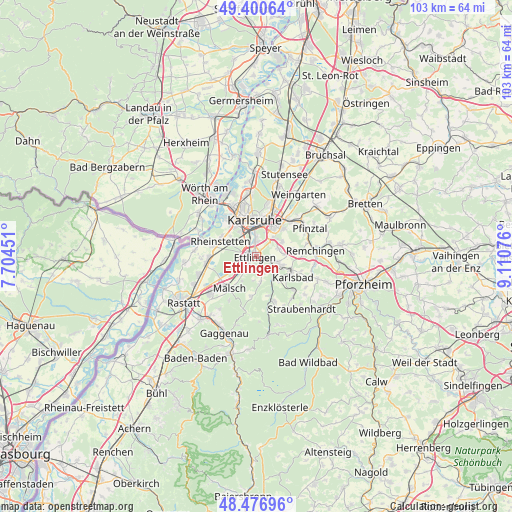
Ettlingen GPS coordinates[2]
48° 56' 27.384" North, 8° 24' 27.468" East
| Map corner | latitude | longitude |
|---|---|---|
| Upper-left | 49.40064°, | 7.70451° |
| Center: | 48.94094°, | 8.40763° |
| Lower-right: | 48.47696°, | 9.11076° |
| Map W x H: | 102.7×102.7 km | = 63.8×63.8mi |
| max Lat: | 55.01917° ⇑83.6% North |
| Ettlingen: | 48.94094° |
| min Lat: | ⇓16.4% South 47.40724° |
| min Long | Ettlingen | max Long |
| 5.92978° | 8.40763° | 14.98853° |
| W 28.1%⇐ | ⇒71.9% E |
Elevation
Elevation of Ettlingen is 139 m = 456 ft, and this is 110.1 m = 361 ft below average elevation for this country.
| Max E: |
1256 m = 4121 ft | 61.9% |
| Avg. | 249.1 m = 817 ft | |
| Ettlingen | 139 m = 456 ft | |
Min E: |
-5 m = -16 ft | 38.1% |
See also: Germany elevation on elevation.city.
Geographical zone
Ettlingen is located in North temperate zone (between Tropic of Cancer and the Arctic Circle). Distance of this North polar circle is 1959.5 km =1217.6 mi to North.| Distance of | km | miles | from Ettlingen |
|---|---|---|---|
| North Pole | 4565.3 | 2836.7 | to North |
| Arctic Circle | 1959.5 | 1217.6 | to North |
| Tropic Cancer | 2835.8 | 1762.1 | to South |
| Equator | 5441.7 | 3381.3 | to South |


Nearby cities:
15 places around Ettlingen: (largest is in red/bold)
• Au am Rhein
12.8 km =8 mi,  274°
274°
• Berg
15.7 km =9.8 mi,  287°
287°
• Bietigheim
11.9 km =7.4 mi,  252°
252°
• Bischweier
14.6 km =9.1 mi,  218°
218°
• Durmersheim
10.3 km =6.4 mi, 265°
• Hagenbach
14.3 km =8.9 mi,  306°
306°
• Jöhlingen
15.8 km =9.8 mi,  50°
50°
• Karlsruhe
7.6 km =4.7 mi,  358°
358°
• Königsbach-Stein
14.7 km =9.1 mi,  79°
79°
• Malsch
8.4 km =5.2 mi, 220°
• Muggensturm
12.3 km =7.6 mi,  227°
227°
• Neuburg
12.9 km =8 mi, 294°
• Rheinstetten
8 km =5 mi, 292°
• Weingarten
15.3 km =9.5 mi,  34°
34°
• Ötigheim
13.8 km =8.6 mi, 246°
Sources, notices
• [Note1] Compared only with cities in Germany existing in our database
• [Src1] Map data: © OpenStreetMap contributors (CC-BY-SA)
• [Src2] Other city data from geonames.org with taken over terms of usage.
• [Src3] Geographical zone / Annual Mean Temperature by Robert A. Rohde @ Wikipedia
