Beulich geodata
Beulich (Rheinland-Pfalz) is a seat of a fourth-order administrative division; located in Germany in Europe/Berlin (GMT+2) time zone. With population of 528 people, there are 9204 cities with bigger population in this country. Compared to other cities in Germany, 59.4% of cities are located further ↑North; 88% of cities are located further →East and 59.1% of cities have lower elevation than Beulich. Note1


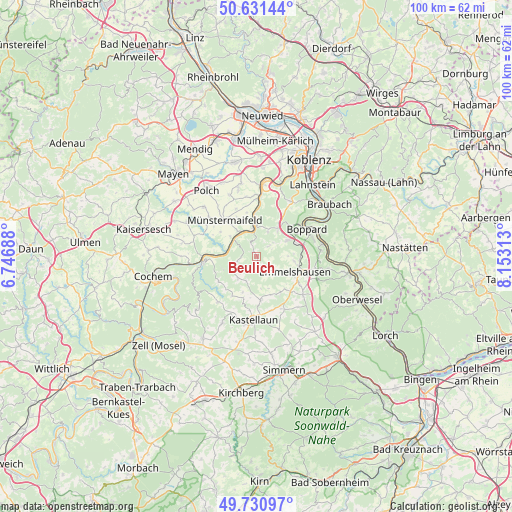
Beulich GPS coordinates[2]
50° 10' 59.988" North, 7° 27' 0" East
| Map corner | latitude | longitude |
|---|---|---|
| Upper-left | 50.63144°, | 6.74688° |
| Center: | 50.18333°, | 7.45° |
| Lower-right: | 49.73097°, | 8.15313° |
| Map W x H: | 100.1×100.1 km | = 62.2×62.2mi |
| max Lat: | 55.01917° ⇑59.4% North |
| Beulich: | 50.18333° |
| min Lat: | ⇓40.6% South 47.40724° |
| min Long | Beulich | max Long |
| 5.92978° | 7.45° | 14.98853° |
| W 12%⇐ | ⇒88% E |
Elevation
Elevation of Beulich is 284 m = 932 ft, and this is 34.9 m = 115 ft above average elevation for this country.
| Max E: |
1256 m = 4121 ft | 40.9% |
| Beulich | 284 m 932 ft | |
| Avg. | 249.1 m = 817 ft | |
Min E: |
-5 m = -16 ft | 59.1% |
See also: Germany elevation on elevation.city.
Geographical zone
Beulich is located in North temperate zone (between Tropic of Cancer and the Arctic Circle). Distance of this North polar circle is 1821.3 km =1131.7 mi to North.| Distance of | km | miles | from Beulich |
|---|---|---|---|
| North Pole | 4427.2 | 2750.9 | to North |
| Arctic Circle | 1821.3 | 1131.7 | to North |
| Tropic Cancer | 2973.9 | 1847.9 | to South |
| Equator | 5579.9 | 3467.2 | to South |


Nearby cities:
15 places around Beulich: (largest is in red/bold)
• Alken
7.4 km =4.6 mi,  0°
0°
• Brodenbach
5.6 km =3.5 mi, 0°
• Burgen
5.3 km =3.3 mi,  305°
305°
• Dommershausen
5.1 km =3.2 mi,  223°
223°
• Gondershausen
5.1 km =3.2 mi,  136°
136°
• Hatzenport
6 km =3.7 mi,  336°
336°
• Kratzenburg
7.1 km =4.4 mi,  90°
90°
• Löf
5.7 km =3.5 mi,  347°
347°
• Lütz
7.4 km =4.6 mi,  255°
255°
• Macken
3.6 km =2.2 mi,  270°
270°
• Mermuth
3 km =1.9 mi,  127°
127°
• Morshausen
2.2 km =1.4 mi,  327°
327°
• Moselkern
5.8 km =3.6 mi,  282°
282°
• Ney
5.9 km =3.7 mi, 90°
• Nörtershausen
4.4 km =2.7 mi,  32°
32°
Sources, notices
• [Note1] Compared only with cities in Germany existing in our database
• [Src1] Map data: © OpenStreetMap contributors (CC-BY-SA)
• [Src2] Other city data from geonames.org with taken over terms of usage.
• [Src3] Geographical zone / Annual Mean Temperature by Robert A. Rohde @ Wikipedia
