Hatzenport geodata
Hatzenport (Rheinland-Pfalz) is a seat of a fourth-order administrative division; located in Germany in Europe/Berlin (GMT+2) time zone. With population of 673 people, there are 8458 cities with bigger population in this country. Compared to other cities in Germany, 58.4% of cities are located further ↑North; 88.4% of cities are located further →East and 53.4% of cities have lower elevation than Hatzenport. Note1
Administrative division(s):
- Level 1: Rheinland-Pfalz
- Level 3: Landkreis Mayen-Koblenz
- Level 4: Hatzenport


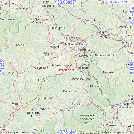
Hatzenport GPS coordinates[2]
50° 13' 59.988" North, 7° 25' 0.012" East
| Map corner | latitude | longitude |
|---|---|---|
| Upper-left | 50.68097°, | 6.71355° |
| Center: | 50.23333°, | 7.41667° |
| Lower-right: | 49.78144°, | 8.1198° |
| Map W x H: | 100×100 km | = 62.1×62.1mi |
| max Lat: | 55.01917° ⇑58.4% North |
| Hatzenport: | 50.23333° |
| min Lat: | ⇓41.6% South 47.40724° |
| min Long | Hatzenport | max Long |
| 5.92978° | 7.41667° | 14.98853° |
| W 11.6%⇐ | ⇒88.4% E |
Elevation
Elevation of Hatzenport is 249 m = 817 ft, and this is 0.099999999999994 m = 0 ft below average elevation for this country.
| Max E: |
1256 m = 4121 ft | 46.6% |
| Avg. | 249.1 m = 817 ft | |
| Hatzenport | 249 m = 817 ft | |
Min E: |
-5 m = -16 ft | 53.4% |
See also: Germany elevation on elevation.city.
Geographical zone
Hatzenport is located in North temperate zone (between Tropic of Cancer and the Arctic Circle). Distance of this North polar circle is 1815.8 km =1128.3 mi to North.| Distance of | km | miles | from Hatzenport |
|---|---|---|---|
| North Pole | 4421.6 | 2747.5 | to North |
| Arctic Circle | 1815.8 | 1128.3 | to North |
| Tropic Cancer | 2979.5 | 1851.4 | to South |
| Equator | 5585.4 | 3470.6 | to South |


Nearby cities:
15 places around Hatzenport: (largest is in red/bold)
• Alken
3 km =1.9 mi,  51°
51°
• Beulich
6 km =3.7 mi,  156°
156°
• Brodenbach
2.4 km =1.5 mi,  90°
90°
• Burgen
3.1 km =1.9 mi,  218°
218°
• Gierschnach
6 km =3.7 mi,  308°
308°
• Kalt
4.1 km =2.5 mi,  337°
337°
• Lehmen
6 km =3.7 mi,  23°
23°
• Löf
1.2 km =0.7 mi, 90°
• Macken
5.7 km =3.5 mi,  192°
192°
• Morshausen
3.9 km =2.4 mi, 162°
• Moselkern
5.4 km =3.4 mi, 216°
• Münstermaifeld
4.1 km =2.5 mi,  290°
290°
• Nörtershausen
5.1 km =3.2 mi,  111°
111°
• Oberfell
3.6 km =2.2 mi,  33°
33°
• Wierschem
4.7 km =2.9 mi,  259°
259°
Sources, notices
• [Note1] Compared only with cities in Germany existing in our database
• [Src1] Map data: © OpenStreetMap contributors (CC-BY-SA)
• [Src2] Other city data from geonames.org with taken over terms of usage.
• [Src3] Geographical zone / Annual Mean Temperature by Robert A. Rohde @ Wikipedia
