Berkheim geodata
Berkheim (Baden-Württemberg) is a seat of a fourth-order administrative division; located in Germany in Europe/Berlin (GMT+2) time zone. With population of 2,657 people, there are 4272 cities with bigger population in this country. Compared to other cities in Germany, 95% of cities are located further ↑North; 51.4% of cities are located further ←West and 93.6% of cities have lower elevation than Berkheim. Note1
Administrative division(s):
- Level 1: Baden-Württemberg
- Level 2: Tübingen Region
- Level 3: Landkreis Biberach
- Level 4: Berkheim


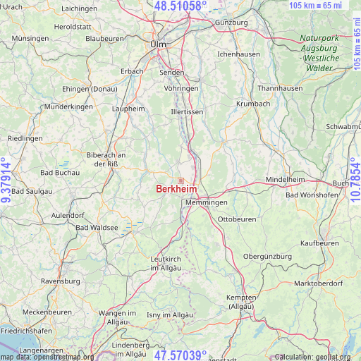
Berkheim GPS coordinates[2]
48° 2' 33.468" North, 10° 4' 56.172" East
| Map corner | latitude | longitude |
|---|---|---|
| Upper-left | 48.51058°, | 9.37914° |
| Center: | 48.04263°, | 10.08227° |
| Lower-right: | 47.57039°, | 10.7854° |
| Map W x H: | 104.5×104.5 km | = 64.9×64.9mi |
| max Lat: | 55.01917° ⇑95% North |
| Berkheim: | 48.04263° |
| min Lat: | ⇓5% South 47.40724° |
| min Long | Berkheim | max Long |
| 5.92978° | 10.08227° | 14.98853° |
| W 51.4%⇐ | ⇒48.6% E |
Elevation
Elevation of Berkheim is 568 m = 1864 ft, and this is 318.9 m = 1046 ft above average elevation for this country.
| Max E: |
1256 m = 4121 ft | 6.4% |
| Berkheim | 568 m 1864 ft | |
| Avg. | 249.1 m = 817 ft | |
Min E: |
-5 m = -16 ft | 93.6% |
See also: Germany elevation on elevation.city.
Geographical zone
Berkheim is located in North temperate zone (between Tropic of Cancer and the Arctic Circle). Distance of this North polar circle is 2059.3 km =1279.6 mi to North.| Distance of | km | miles | from Berkheim |
|---|---|---|---|
| North Pole | 4665.2 | 2898.8 | to North |
| Arctic Circle | 2059.3 | 1279.6 | to North |
| Tropic Cancer | 2735.9 | 1700 | to South |
| Equator | 5341.8 | 3319.2 | to South |


Nearby cities:
15 places around Berkheim: (largest is in red/bold)
• Amendingen
8.4 km =5.2 mi,  121°
121°
• Boos
9.1 km =5.7 mi,  66°
66°
• Buxheim
6.1 km =3.8 mi,  141°
141°
• Dettingen an der Iller
6.9 km =4.3 mi,  21°
21°
• Erlenmoos
8.3 km =5.2 mi,  287°
287°
• Erolzheim
5.3 km =3.3 mi,  352°
352°
• Fellheim
6.2 km =3.9 mi,  57°
57°
• Heimertingen
5.1 km =3.2 mi,  101°
101°
• Kirchdorf
5 km =3.1 mi,  40°
40°
• Niederrieden
7.7 km =4.8 mi,  77°
77°
• Pless
7.6 km =4.7 mi, 42°
• Rot an der Rot
5.1 km =3.2 mi,  229°
229°
• Steinhausen an der Rottum
9.1 km =5.7 mi,  251°
251°
• Steinheim
6.6 km =4.1 mi, 117°
• Tannheim
4.7 km =2.9 mi,  179°
179°
Sources, notices
• [Note1] Compared only with cities in Germany existing in our database
• [Src1] Map data: © OpenStreetMap contributors (CC-BY-SA)
• [Src2] Other city data from geonames.org with taken over terms of usage.
• [Src3] Geographical zone / Annual Mean Temperature by Robert A. Rohde @ Wikipedia
