Beidenfleth geodata
Beidenfleth (Schleswig-Holstein) is a seat of a fourth-order administrative division; located in Germany in Europe/Berlin (GMT+2) time zone. With population of 951 people, there are 7345 cities with bigger population in this country. Compared to other cities in Germany, 90.9% of cities are located further ↓South; 59.1% of cities are located further →East and 98.6% of cities have higher elevation than Beidenfleth. Note1
Administrative division(s):
- Level 1: Schleswig-Holstein
- Level 3: Kreis Steinburg
- Level 4: Beidenfleth


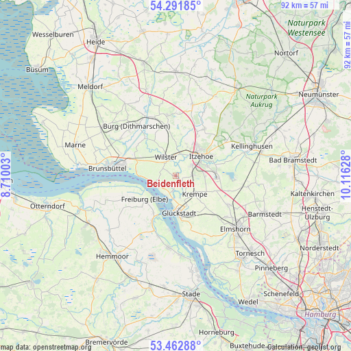
Beidenfleth GPS coordinates[2]
53° 52' 45.912" North, 9° 24' 47.34" East
| Map corner | latitude | longitude |
|---|---|---|
| Upper-left | 54.29185°, | 8.71003° |
| Center: | 53.87942°, | 9.41315° |
| Lower-right: | 53.46288°, | 10.11628° |
| Map W x H: | 92.2×92.2 km | = 57.3×57.3mi |
| max Lat: | 55.01917° ⇑9.1% North |
| Beidenfleth: | 53.87942° |
| min Lat: | ⇓90.9% South 47.40724° |
| min Long | Beidenfleth | max Long |
| 5.92978° | 9.41315° | 14.98853° |
| W 40.9%⇐ | ⇒59.1% E |
Elevation
Elevation of Beidenfleth is 1 m = 3 ft, and this is 248.1 m = 814 ft below average elevation for this country.
| Max E: |
1256 m = 4121 ft | 98.6% |
| Avg. | 249.1 m = 817 ft | |
| Beidenfleth | 1 m = 3 ft | |
Min E: |
-5 m = -16 ft | 1.4% |
See also: Germany elevation on elevation.city.
Geographical zone
Beidenfleth is located in North temperate zone (between Tropic of Cancer and the Arctic Circle). Distance of this North polar circle is 1410.3 km =876.3 mi to North.| Distance of | km | miles | from Beidenfleth |
|---|---|---|---|
| North Pole | 4016.2 | 2495.6 | to North |
| Arctic Circle | 1410.3 | 876.3 | to North |
| Tropic Cancer | 3384.9 | 2103.3 | to South |
| Equator | 5990.8 | 3722.5 | to South |


Nearby cities:
15 places around Beidenfleth: (largest is in red/bold)
• Bahrenfleth
2 km =1.2 mi,  117°
117°
• Bekdorf
6.7 km =4.2 mi,  5°
5°
• Bekmünde
5.5 km =3.4 mi,  23°
23°
• Borsfleth
5.3 km =3.3 mi,  165°
165°
• Brokdorf
6.2 km =3.9 mi,  253°
253°
• Dammfleth
4.2 km =2.6 mi,  321°
321°
• Heiligenstedtenerkamp
4.2 km =2.6 mi,  58°
58°
• Hodorf
2.6 km =1.6 mi,  25°
25°
• Krempdorf
6.2 km =3.9 mi,  145°
145°
• Kremperheide
4.3 km =2.7 mi,  78°
78°
• Krempermoor
4.4 km =2.7 mi,  93°
93°
• Landrecht
6.7 km =4.2 mi,  333°
333°
• Stördorf
4.1 km =2.5 mi, 11°
• Wewelsfleth
3.4 km =2.1 mi,  194°
194°
• Wilster
5.4 km =3.4 mi, 332°
Sources, notices
• [Note1] Compared only with cities in Germany existing in our database
• [Src1] Map data: © OpenStreetMap contributors (CC-BY-SA)
• [Src2] Other city data from geonames.org with taken over terms of usage.
• [Src3] Geographical zone / Annual Mean Temperature by Robert A. Rohde @ Wikipedia
