Wewelsfleth geodata
Wewelsfleth (Schleswig-Holstein) is a seat of a fourth-order administrative division; located in Germany in Europe/Berlin (GMT+2) time zone. With population of 1,538 people, there are 5800 cities with bigger population in this country. Compared to other cities in Germany, 90.6% of cities are located further ↓South; 59.3% of cities are located further →East and 99.9% of cities have higher elevation than Wewelsfleth. Note1
Administrative division(s):
- Level 1: Schleswig-Holstein
- Level 3: Kreis Steinburg
- Level 4: Wewelsfleth


Wewelsfleth GPS coordinates[2]
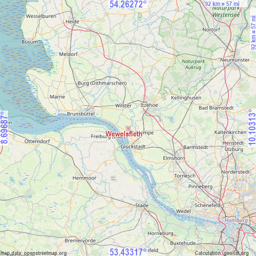
53° 51' 0" North, 9° 24' 0" East
| Map corner | latitude | longitude |
|---|---|---|
| Upper-left | 54.26272°, | 8.69687° |
| Center: | 53.85°, | 9.4° |
| Lower-right: | 53.43317°, | 10.10313° |
| Map W x H: | 92.2×92.2 km | = 57.3×57.3mi |
| max Lat: | 55.01917° ⇑9.4% North |
| Wewelsfleth: | 53.85° |
| min Lat: | ⇓90.6% South 47.40724° |
| min Long | Wewelsfleth | max Long |
| 5.92978° | 9.4° | 14.98853° |
| W 40.7%⇐ | ⇒59.3% E |
Elevation
Elevation of Wewelsfleth is -3 m = -10 ft, and this is 252.1 m = 827 ft below average elevation for this country.
| Max E: |
1256 m = 4121 ft | 99.9% |
| Avg. | 249.1 m = 817 ft | |
| Wewelsfleth | -3 m = -10 ft | |
Min E: |
-5 m = -16 ft | 0.1% |
See also: Germany elevation on elevation.city.
Geographical zone
Wewelsfleth is located in North temperate zone (between Tropic of Cancer and the Arctic Circle). Distance of this North polar circle is 1413.6 km =878.4 mi to North.| Distance of | km | miles | from Wewelsfleth |
|---|---|---|---|
| North Pole | 4019.5 | 2497.6 | to North |
| Arctic Circle | 1413.6 | 878.4 | to North |
| Tropic Cancer | 3381.6 | 2101.2 | to South |
| Equator | 5987.6 | 3720.5 | to South |


Nearby cities:
15 places around Wewelsfleth: (largest is in red/bold)
• Bahrenfleth
3.5 km =2.2 mi,  47°
47°
• Beidenfleth
3.4 km =2.1 mi,  14°
14°
• Blomesche Wildnis
5.7 km =3.5 mi,  168°
168°
• Borsfleth
2.9 km =1.8 mi,  130°
130°
• Brokdorf
5.3 km =3.3 mi,  286°
286°
• Dammfleth
6.8 km =4.2 mi,  344°
344°
• Elskop
6.6 km =4.1 mi,  124°
124°
• Glückstadt
7 km =4.3 mi, 166°
• Heiligenstedtenerkamp
7.1 km =4.4 mi,  39°
39°
• Hodorf
6 km =3.7 mi,  19°
19°
• Krempdorf
4.8 km =3 mi,  112°
112°
• Krempe
6 km =3.7 mi,  104°
104°
• Kremperheide
6.6 km =4.1 mi, 51°
• Krempermoor
6.1 km =3.8 mi,  60°
60°
• Stördorf
7.5 km =4.7 mi, 13°
Sources, notices
• [Note1] Compared only with cities in Germany existing in our database
• [Src1] Map data: © OpenStreetMap contributors (CC-BY-SA)
• [Src2] Other city data from geonames.org with taken over terms of usage.
• [Src3] Geographical zone / Annual Mean Temperature by Robert A. Rohde @ Wikipedia
