Baumholder geodata
Baumholder (Rheinland-Pfalz) is a populated place; located in Germany in Europe/Berlin (GMT+2) time zone. With population of 4,106 people, there are 3224 cities with bigger population in this country. Compared to other cities in Germany, 73.3% of cities are located further ↑North; 89.4% of cities are located further →East and 84.7% of cities have lower elevation than Baumholder. Note1
Administrative division(s):
- Level 1: Rheinland-Pfalz
- Level 3: Landkreis Birkenfeld
- Level 4: Baumholder


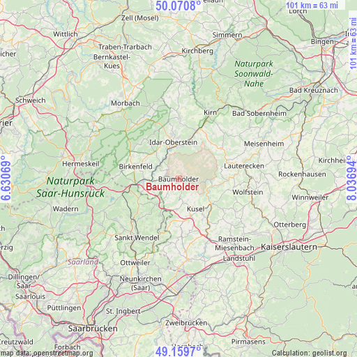
Baumholder GPS coordinates[2]
49° 37' 2.568" North, 7° 20' 1.716" East
| Map corner | latitude | longitude |
|---|---|---|
| Upper-left | 50.0708°, | 6.63069° |
| Center: | 49.61738°, | 7.33381° |
| Lower-right: | 49.1597°, | 8.03694° |
| Map W x H: | 101.3×101.3 km | = 62.9×62.9mi |
| max Lat: | 55.01917° ⇑73.3% North |
| Baumholder: | 49.61738° |
| min Lat: | ⇓26.7% South 47.40724° |
| min Long | Baumholder | max Long |
| 5.92978° | 7.33381° | 14.98853° |
| W 10.6%⇐ | ⇒89.4% E |
Elevation
Elevation of Baumholder is 466 m = 1529 ft, and this is 216.9 m = 712 ft above average elevation for this country.
| Max E: |
1256 m = 4121 ft | 15.3% |
| Baumholder | 466 m 1529 ft | |
| Avg. | 249.1 m = 817 ft | |
Min E: |
-5 m = -16 ft | 84.7% |
See also: Germany elevation on elevation.city.
Geographical zone
Baumholder is located in North temperate zone (between Tropic of Cancer and the Arctic Circle). Distance of this North polar circle is 1884.2 km =1170.8 mi to North.| Distance of | km | miles | from Baumholder |
|---|---|---|---|
| North Pole | 4490.1 | 2790 | to North |
| Arctic Circle | 1884.2 | 1170.8 | to North |
| Tropic Cancer | 2911 | 1808.8 | to South |
| Equator | 5516.9 | 3428 | to South |


Nearby cities:
15 places around Baumholder: (largest is in red/bold)
• Berglangenbach
6.3 km =3.9 mi,  252°
252°
• Dennweiler-Frohnbach
5.2 km =3.2 mi,  136°
136°
• Fohren-Linden
5.3 km =3.3 mi,  223°
223°
• Frauenberg
6.6 km =4.1 mi,  326°
326°
• Heimbach
6 km =3.7 mi,  269°
269°
• Kronweiler
6 km =3.7 mi,  306°
306°
• Körborn
6.1 km =3.8 mi,  157°
157°
• Mettweiler
4 km =2.5 mi,  198°
198°
• Nohen
6.3 km =3.9 mi,  286°
286°
• Oberalben
6.1 km =3.8 mi,  128°
128°
• Reichenbach
4.3 km =2.7 mi, 307°
• Rohrbach
6.1 km =3.8 mi,  231°
231°
• Ruschberg
3.2 km =2 mi, 274°
• Sonnenberg-Winnenberg
6.6 km =4.1 mi, 326°
• Thallichtenberg
6.7 km =4.2 mi,  169°
169°
Sources, notices
• [Note1] Compared only with cities in Germany existing in our database
• [Src1] Map data: © OpenStreetMap contributors (CC-BY-SA)
• [Src2] Other city data from geonames.org with taken over terms of usage.
• [Src3] Geographical zone / Annual Mean Temperature by Robert A. Rohde @ Wikipedia
