Baltmannsweiler geodata
Baltmannsweiler (Baden-Württemberg) is a seat of a fourth-order administrative division; located in Germany in Europe/Berlin (GMT+2) time zone. With population of 5,584 people, there are 2600 cities with bigger population in this country. Compared to other cities in Germany, 86% of cities are located further ↑North; 58.6% of cities are located further →East and 83.3% of cities have lower elevation than Baltmannsweiler. Note1
Administrative division(s):
- Level 1: Baden-Württemberg
- Level 2: Regierungsbezirk Stuttgart
- Level 3: Landkreis Esslingen
- Level 4: Baltmannsweiler


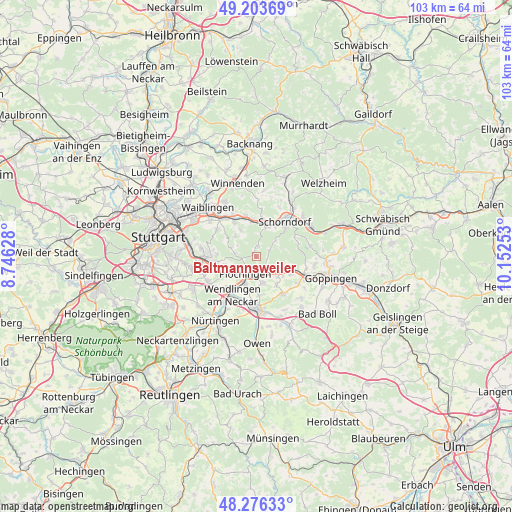
Baltmannsweiler GPS coordinates[2]
48° 44' 31.74" North, 9° 26' 57.84" East
| Map corner | latitude | longitude |
|---|---|---|
| Upper-left | 49.20369°, | 8.74628° |
| Center: | 48.74215°, | 9.4494° |
| Lower-right: | 48.27633°, | 10.15253° |
| Map W x H: | 103.1×103.1 km | = 64.1×64.1mi |
| max Lat: | 55.01917° ⇑86% North |
| Baltmannsweiler: | 48.74215° |
| min Lat: | ⇓14% South 47.40724° |
| min Long | Baltmannsweiler | max Long |
| 5.92978° | 9.4494° | 14.98853° |
| W 41.4%⇐ | ⇒58.6% E |
Elevation
Elevation of Baltmannsweiler is 456 m = 1496 ft, and this is 206.9 m = 679 ft above average elevation for this country.
| Max E: |
1256 m = 4121 ft | 16.7% |
| Baltmannsweiler | 456 m 1496 ft | |
| Avg. | 249.1 m = 817 ft | |
Min E: |
-5 m = -16 ft | 83.3% |
See also: Germany elevation on elevation.city.
Geographical zone
Baltmannsweiler is located in North temperate zone (between Tropic of Cancer and the Arctic Circle). Distance of this North polar circle is 1981.6 km =1231.3 mi to North.| Distance of | km | miles | from Baltmannsweiler |
|---|---|---|---|
| North Pole | 4587.4 | 2850.5 | to North |
| Arctic Circle | 1981.6 | 1231.3 | to North |
| Tropic Cancer | 2813.7 | 1748.4 | to South |
| Equator | 5419.6 | 3367.6 | to South |


Nearby cities:
15 places around Baltmannsweiler: (largest is in red/bold)
• Albershausen
10.2 km =6.3 mi,  123°
123°
• Altbach
5.5 km =3.4 mi,  246°
246°
• Deizisau
5.7 km =3.5 mi,  234°
234°
• Ebersbach an der Fils
6.2 km =3.9 mi, 118°
• Hochdorf
5.6 km =3.5 mi,  168°
168°
• Köngen
8.9 km =5.5 mi,  222°
222°
• Notzingen
8 km =5 mi,  175°
175°
• Plochingen
4.1 km =2.5 mi,  212°
212°
• Reichenbach an der Fils
3.7 km =2.3 mi,  162°
162°
• Schlierbach
9.1 km =5.7 mi,  146°
146°
• Schorndorf
9.1 km =5.7 mi,  39°
39°
• Weinstadt-Endersbach
10.1 km =6.3 mi,  321°
321°
• Wendlingen am Neckar
9.5 km =5.9 mi, 214°
• Wernau
6 km =3.7 mi,  204°
204°
• Winterbach
6.7 km =4.2 mi,  18°
18°
Sources, notices
• [Note1] Compared only with cities in Germany existing in our database
• [Src1] Map data: © OpenStreetMap contributors (CC-BY-SA)
• [Src2] Other city data from geonames.org with taken over terms of usage.
• [Src3] Geographical zone / Annual Mean Temperature by Robert A. Rohde @ Wikipedia
