Bad Herrenalb geodata
Bad Herrenalb (Baden-Württemberg) is a populated place; located in Germany in Europe/Berlin (GMT+2) time zone. With population of 7,521 people, there are 2064 cities with bigger population in this country. Compared to other cities in Germany, 85.4% of cities are located further ↑North; 71.6% of cities are located further →East and 70.9% of cities have lower elevation than Bad Herrenalb. Note1
Administrative division(s):
- Level 1: Baden-Württemberg
- Level 2: Karlsruhe Region
- Level 3: Landkreis Calw
- Level 4: Bad Herrenalb


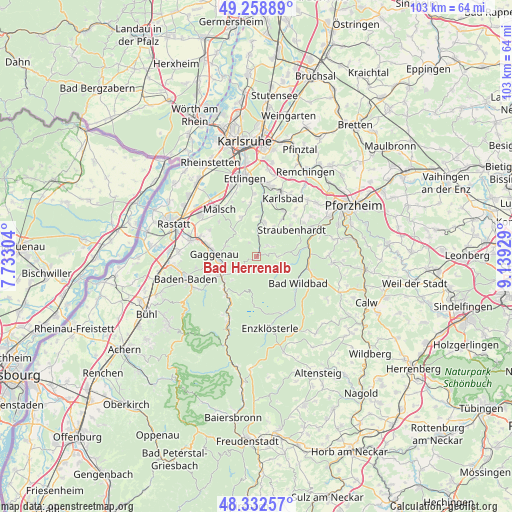
Bad Herrenalb GPS coordinates[2]
48° 47' 52.332" North, 8° 26' 10.212" East
| Map corner | latitude | longitude |
|---|---|---|
| Upper-left | 49.25889°, | 7.73304° |
| Center: | 48.79787°, | 8.43617° |
| Lower-right: | 48.33257°, | 9.13929° |
| Map W x H: | 103×103 km | = 64×64mi |
| max Lat: | 55.01917° ⇑85.4% North |
| Bad Herrenalb: | 48.79787° |
| min Lat: | ⇓14.6% South 47.40724° |
| min Long | Bad Herrenalb | max Long |
| 5.92978° | 8.43617° | 14.98853° |
| W 28.4%⇐ | ⇒71.6% E |
Elevation
Elevation of Bad Herrenalb is 365 m = 1198 ft, and this is 115.9 m = 380 ft above average elevation for this country.
| Max E: |
1256 m = 4121 ft | 29.1% |
| Bad Herrenalb | 365 m 1198 ft | |
| Avg. | 249.1 m = 817 ft | |
Min E: |
-5 m = -16 ft | 70.9% |
See also: Germany elevation on elevation.city.
Geographical zone
Bad Herrenalb is located in North temperate zone (between Tropic of Cancer and the Arctic Circle). Distance of this North polar circle is 1975.4 km =1227.5 mi to North.| Distance of | km | miles | from Bad Herrenalb |
|---|---|---|---|
| North Pole | 4581.2 | 2846.6 | to North |
| Arctic Circle | 1975.4 | 1227.5 | to North |
| Tropic Cancer | 2819.9 | 1752.2 | to South |
| Equator | 5425.8 | 3371.4 | to South |


Nearby cities:
15 places around Bad Herrenalb: (largest is in red/bold)
• Bad Wildbad
9.9 km =6.2 mi,  122°
122°
• Baden-Baden
15 km =9.3 mi,  253°
253°
• Bischweier
12 km =7.5 mi,  291°
291°
• Dobel
4.7 km =2.9 mi,  87°
87°
• Enzklösterle
14.8 km =9.2 mi,  170°
170°
• Forbach
14.2 km =8.8 mi,  206°
206°
• Gaggenau
7.5 km =4.7 mi,  271°
271°
• Gernsbach
7.5 km =4.7 mi, 245°
• Höfen an der Enz
10.8 km =6.7 mi, 88°
• Kuppenheim
13.7 km =8.5 mi,  284°
284°
• Loffenau
4.7 km =2.9 mi,  232°
232°
• Malsch
12.1 km =7.5 mi,  321°
321°
• Muggensturm
13.6 km =8.5 mi,  304°
304°
• Neuenbürg
12.8 km =8 mi,  65°
65°
• Weisenbach
9.9 km =6.2 mi,  217°
217°
Sources, notices
• [Note1] Compared only with cities in Germany existing in our database
• [Src1] Map data: © OpenStreetMap contributors (CC-BY-SA)
• [Src2] Other city data from geonames.org with taken over terms of usage.
• [Src3] Geographical zone / Annual Mean Temperature by Robert A. Rohde @ Wikipedia
