Angelroda geodata
Angelroda (Thuringia) is a seat of a fourth-order administrative division; located in Germany in Europe/Berlin (GMT+2) time zone. With population of 445 people, there are 9556 cities with bigger population in this country. Compared to other cities in Germany, 53.2% of cities are located further ↓South; 65% of cities are located further ←West and 72.2% of cities have lower elevation than Angelroda. Note1


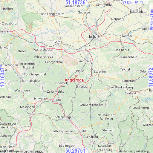
Angelroda GPS coordinates[2]
50° 44' 40.38" North, 10° 51' 59.724" East
| Map corner | latitude | longitude |
|---|---|---|
| Upper-left | 51.18736°, | 10.16347° |
| Center: | 50.74455°, | 10.86659° |
| Lower-right: | 50.29751°, | 11.56972° |
| Map W x H: | 98.9×98.9 km | = 61.5×61.5mi |
| max Lat: | 55.01917° ⇑46.8% North |
| Angelroda: | 50.74455° |
| min Lat: | ⇓53.2% South 47.40724° |
| min Long | Angelroda | max Long |
| 5.92978° | 10.86659° | 14.98853° |
| W 65%⇐ | ⇒35% E |
Elevation
Elevation of Angelroda is 375 m = 1230 ft, and this is 125.9 m = 413 ft above average elevation for this country.
| Max E: |
1256 m = 4121 ft | 27.8% |
| Angelroda | 375 m 1230 ft | |
| Avg. | 249.1 m = 817 ft | |
Min E: |
-5 m = -16 ft | 72.2% |
See also: Germany elevation on elevation.city.
Geographical zone
Angelroda is located in North temperate zone (between Tropic of Cancer and the Arctic Circle). Distance of this North polar circle is 1758.9 km =1092.9 mi to North.| Distance of | km | miles | from Angelroda |
|---|---|---|---|
| North Pole | 4364.8 | 2712.2 | to North |
| Arctic Circle | 1758.9 | 1092.9 | to North |
| Tropic Cancer | 3036.3 | 1886.7 | to South |
| Equator | 5642.3 | 3506 | to South |


Nearby cities:
15 places around Angelroda: (largest is in red/bold)
• Crawinkel
7.3 km =4.5 mi,  306°
306°
• Elgersburg
4.4 km =2.7 mi,  192°
192°
• Frankenhain
5.7 km =3.5 mi,  283°
283°
• Gehlberg
9.1 km =5.7 mi,  215°
215°
• Geraberg
3.8 km =2.4 mi,  212°
212°
• Geschwenda
3.2 km =2 mi,  243°
243°
• Gossel
6.3 km =3.9 mi,  349°
349°
• Gräfenroda
4 km =2.5 mi, 275°
• Ilmenau
7.7 km =4.8 mi,  151°
151°
• Liebenstein
2.7 km =1.7 mi,  334°
334°
• Martinroda
2.8 km =1.7 mi, 146°
• Neuhaus
8.3 km =5.2 mi, 145°
• Neusiß
1.6 km =1 mi,  88°
88°
• Plaue
4.4 km =2.7 mi,  31°
31°
• Wölfis
9.4 km =5.8 mi,  319°
319°
Sources, notices
• [Note1] Compared only with cities in Germany existing in our database
• [Src1] Map data: © OpenStreetMap contributors (CC-BY-SA)
• [Src2] Other city data from geonames.org with taken over terms of usage.
• [Src3] Geographical zone / Annual Mean Temperature by Robert A. Rohde @ Wikipedia
