Frankenhain geodata
Frankenhain (Thuringia) is a seat of a fourth-order administrative division; located in Germany in Europe/Berlin (GMT+2) time zone. With population of 850 people, there are 7703 cities with bigger population in this country. Compared to other cities in Germany, 53.4% of cities are located further ↓South; 63.9% of cities are located further ←West and 85.5% of cities have lower elevation than Frankenhain. Note1


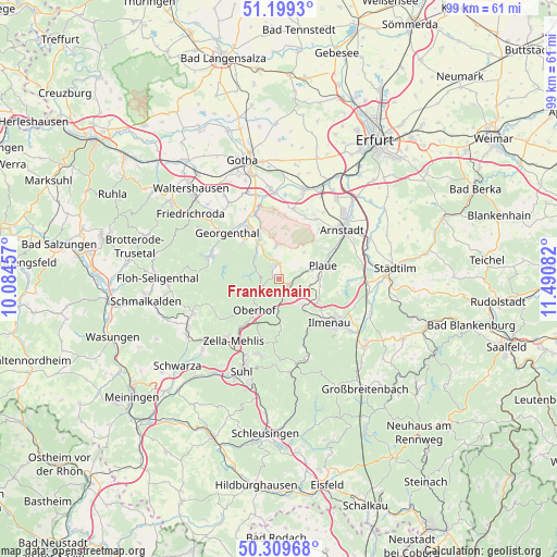
Frankenhain GPS coordinates[2]
50° 45' 23.76" North, 10° 47' 15.684" East
| Map corner | latitude | longitude |
|---|---|---|
| Upper-left | 51.1993°, | 10.08457° |
| Center: | 50.7566°, | 10.78769° |
| Lower-right: | 50.30968°, | 11.49082° |
| Map W x H: | 98.9×98.9 km | = 61.5×61.5mi |
| max Lat: | 55.01917° ⇑46.6% North |
| Frankenhain: | 50.7566° |
| min Lat: | ⇓53.4% South 47.40724° |
| min Long | Frankenhain | max Long |
| 5.92978° | 10.78769° | 14.98853° |
| W 63.9%⇐ | ⇒36.1% E |
Elevation
Elevation of Frankenhain is 473 m = 1552 ft, and this is 223.9 m = 735 ft above average elevation for this country.
| Max E: |
1256 m = 4121 ft | 14.5% |
| Frankenhain | 473 m 1552 ft | |
| Avg. | 249.1 m = 817 ft | |
Min E: |
-5 m = -16 ft | 85.5% |
See also: Germany elevation on elevation.city.
Geographical zone
Frankenhain is located in North temperate zone (between Tropic of Cancer and the Arctic Circle). Distance of this North polar circle is 1757.6 km =1092.1 mi to North.| Distance of | km | miles | from Frankenhain |
|---|---|---|---|
| North Pole | 4363.5 | 2711.4 | to North |
| Arctic Circle | 1757.6 | 1092.1 | to North |
| Tropic Cancer | 3037.7 | 1887.5 | to South |
| Equator | 5643.6 | 3506.8 | to South |


Nearby cities:
15 places around Frankenhain: (largest is in red/bold)
• Angelroda
5.7 km =3.5 mi,  103°
103°
• Crawinkel
3 km =1.9 mi,  354°
354°
• Elgersburg
7.3 km =4.5 mi,  140°
140°
• Gehlberg
8.7 km =5.4 mi,  178°
178°
• Geraberg
5.7 km =3.5 mi, 142°
• Geschwenda
3.8 km =2.4 mi, 136°
• Gossel
6.5 km =4 mi,  42°
42°
• Gräfenroda
1.9 km =1.2 mi,  121°
121°
• Liebenstein
4.5 km =2.8 mi,  75°
75°
• Luisenthal
4.8 km =3 mi,  307°
307°
• Martinroda
8 km =5 mi, 117°
• Neusiß
7.3 km =4.5 mi, 100°
• Oberhof
7.2 km =4.5 mi,  216°
216°
• Plaue
8.2 km =5.1 mi,  72°
72°
• Wölfis
5.8 km =3.6 mi, 353°
Sources, notices
• [Note1] Compared only with cities in Germany existing in our database
• [Src1] Map data: © OpenStreetMap contributors (CC-BY-SA)
• [Src2] Other city data from geonames.org with taken over terms of usage.
• [Src3] Geographical zone / Annual Mean Temperature by Robert A. Rohde @ Wikipedia
