Amtzell geodata
Amtzell (Baden-Württemberg) is a seat of a fourth-order administrative division; located in Germany in Europe/Berlin (GMT+2) time zone. With population of 3,530 people, there are 3592 cities with bigger population in this country. Compared to other cities in Germany, 98.8% of cities are located further ↑North; 53.6% of cities are located further →East and 93.1% of cities have lower elevation than Amtzell. Note1
Administrative division(s):
- Level 1: Baden-Württemberg
- Level 2: Tübingen Region
- Level 3: Landkreis Ravensburg
- Level 4: Amtzell


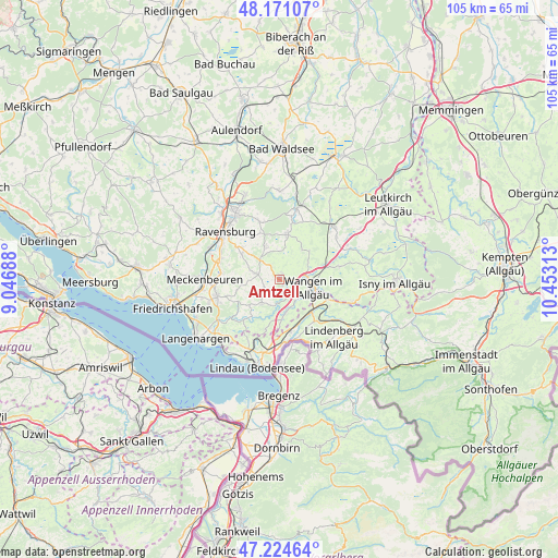
Amtzell GPS coordinates[2]
47° 42' 0" North, 9° 45' 0" East
| Map corner | latitude | longitude |
|---|---|---|
| Upper-left | 48.17107°, | 9.04688° |
| Center: | 47.7°, | 9.75° |
| Lower-right: | 47.22464°, | 10.45313° |
| Map W x H: | 105.2×105.2 km | = 65.4×65.4mi |
| max Lat: | 55.01917° ⇑98.8% North |
| Amtzell: | 47.7° |
| min Lat: | ⇓1.2% South 47.40724° |
| min Long | Amtzell | max Long |
| 5.92978° | 9.75° | 14.98853° |
| W 46.4%⇐ | ⇒53.6% E |
Elevation
Elevation of Amtzell is 559 m = 1834 ft, and this is 309.9 m = 1017 ft above average elevation for this country.
| Max E: |
1256 m = 4121 ft | 6.9% |
| Amtzell | 559 m 1834 ft | |
| Avg. | 249.1 m = 817 ft | |
Min E: |
-5 m = -16 ft | 93.1% |
See also: Germany elevation on elevation.city.
Geographical zone
Amtzell is located in North temperate zone (between Tropic of Cancer and the Arctic Circle). Distance of this North polar circle is 2097.4 km =1303.3 mi to North.| Distance of | km | miles | from Amtzell |
|---|---|---|---|
| North Pole | 4703.3 | 2922.5 | to North |
| Arctic Circle | 2097.4 | 1303.3 | to North |
| Tropic Cancer | 2697.8 | 1676.3 | to South |
| Equator | 5303.7 | 3295.6 | to South |


Nearby cities:
15 places around Amtzell: (largest is in red/bold)
• Bodnegg
4.7 km =2.9 mi,  283°
283°
• Grünkraut
8.6 km =5.3 mi,  304°
304°
• Hergatz
8.4 km =5.2 mi,  131°
131°
• Hergensweiler
9.6 km =6 mi,  164°
164°
• Meckenbeuren
13.7 km =8.5 mi,  270°
270°
• Neukirch
5.9 km =3.7 mi,  216°
216°
• Niederwangen
4.8 km =3 mi, 130°
• Opfenbach
9.7 km =6 mi,  139°
139°
• Schlier
9.7 km =6 mi,  323°
323°
• Sigmarszell
13 km =8.1 mi,  174°
174°
• Tettnang
12.4 km =7.7 mi,  253°
253°
• Vogt
7.5 km =4.7 mi,  9°
9°
• Waldburg
6.9 km =4.3 mi,  336°
336°
• Wangen
6.3 km =3.9 mi,  100°
100°
• Weißensberg
13.3 km =8.3 mi,  187°
187°
Sources, notices
• [Note1] Compared only with cities in Germany existing in our database
• [Src1] Map data: © OpenStreetMap contributors (CC-BY-SA)
• [Src2] Other city data from geonames.org with taken over terms of usage.
• [Src3] Geographical zone / Annual Mean Temperature by Robert A. Rohde @ Wikipedia
