Wangen geodata
Wangen (Baden-Württemberg) is a populated place; located in Germany in Europe/Berlin (GMT+2) time zone. With population of 27,045 people, there are 533 cities with bigger population in this country. Compared to other cities in Germany, 98.9% of cities are located further ↑North; 52.4% of cities are located further →East and 93.9% of cities have lower elevation than Wangen. Note1
Administrative division(s):
- Level 1: Baden-Württemberg
- Level 2: Tübingen Region
- Level 3: Landkreis Ravensburg
- Level 4: Wangen im Allgäu


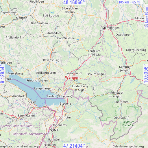
Wangen GPS coordinates[2]
47° 41' 22.2" North, 9° 49' 56.892" East
| Map corner | latitude | longitude |
|---|---|---|
| Upper-left | 48.16066°, | 9.12934° |
| Center: | 47.6895°, | 9.83247° |
| Lower-right: | 47.21404°, | 10.5356° |
| Map W x H: | 105.3×105.3 km | = 65.4×65.4mi |
| max Lat: | 55.01917° ⇑98.9% North |
| Wangen: | 47.6895° |
| min Lat: | ⇓1.1% South 47.40724° |
| min Long | Wangen | max Long |
| 5.92978° | 9.83247° | 14.98853° |
| W 47.6%⇐ | ⇒52.4% E |
Elevation
Elevation of Wangen is 572 m = 1877 ft, and this is 322.9 m = 1059 ft above average elevation for this country.
| Max E: |
1256 m = 4121 ft | 6.1% |
| Wangen | 572 m 1877 ft | |
| Avg. | 249.1 m = 817 ft | |
Min E: |
-5 m = -16 ft | 93.9% |
See also: Germany elevation on elevation.city.
Geographical zone
Wangen is located in North temperate zone (between Tropic of Cancer and the Arctic Circle). Distance of this North polar circle is 2098.6 km =1304 mi to North.| Distance of | km | miles | from Wangen |
|---|---|---|---|
| North Pole | 4704.5 | 2923.2 | to North |
| Arctic Circle | 2098.6 | 1304 | to North |
| Tropic Cancer | 2696.7 | 1675.7 | to South |
| Equator | 5302.6 | 3294.9 | to South |


Nearby cities:
15 places around Wangen: (largest is in red/bold)
• Amtzell
6.3 km =3.9 mi,  280°
280°
• Bodnegg
11 km =6.8 mi, 282°
• Gestratz
12.1 km =7.5 mi,  111°
111°
• Heimenkirch
8.5 km =5.3 mi,  141°
141°
• Hergatz
4.4 km =2.7 mi,  179°
179°
• Hergensweiler
8.9 km =5.5 mi,  204°
204°
• Kißlegg
11.7 km =7.3 mi,  19°
19°
• Neukirch
10.3 km =6.4 mi,  249°
249°
• Niederwangen
3.2 km =2 mi,  232°
232°
• Opfenbach
6.2 km =3.9 mi, 179°
• Röthenbach
12.9 km =8 mi,  124°
124°
• Scheidegg
12.1 km =7.5 mi,  174°
174°
• Sigmarszell
12.8 km =8 mi, 202°
• Vogt
9.9 km =6.2 mi,  330°
330°
• Waldburg
11.7 km =7.3 mi,  310°
310°
Sources, notices
• [Note1] Compared only with cities in Germany existing in our database
• [Src1] Map data: © OpenStreetMap contributors (CC-BY-SA)
• [Src2] Other city data from geonames.org with taken over terms of usage.
• [Src3] Geographical zone / Annual Mean Temperature by Robert A. Rohde @ Wikipedia
