Altenroda geodata
Altenroda (Saxony-Anhalt) is a populated place; located in Germany in Europe/Berlin (GMT+2) time zone. With population of 557 people, there are 9045 cities with bigger population in this country. Compared to other cities in Germany, 62.2% of cities are located further ↓South; 75.3% of cities are located further ←West and 51.7% of cities have lower elevation than Altenroda. Note1


Altenroda GPS coordinates[2]
51° 14' 24.216" North, 11° 33' 53.532" East
| Map corner | latitude | longitude |
|---|---|---|
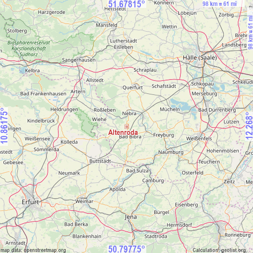
| Upper-left | 51.67815°, | 10.86175° |
| Center: | 51.24006°, | 11.56487° |
| Lower-right: | 50.79775°, | 12.268° |
| Map W x H: | 97.9×97.9 km | = 60.8×60.8mi |
| max Lat: | 55.01917° ⇑37.8% North |
| Altenroda: | 51.24006° |
| min Lat: | ⇓62.2% South 47.40724° |
| min Long | Altenroda | max Long |
| 5.92978° | 11.56487° | 14.98853° |
| W 75.3%⇐ | ⇒24.7% E |
Elevation
Elevation of Altenroda is 238 m = 781 ft, and this is 11.1 m = 36 ft below average elevation for this country.
| Max E: |
1256 m = 4121 ft | 48.3% |
| Avg. | 249.1 m = 817 ft | |
| Altenroda | 238 m = 781 ft | |
Min E: |
-5 m = -16 ft | 51.7% |
See also: Germany elevation on elevation.city.
Geographical zone
Altenroda is located in North temperate zone (between Tropic of Cancer and the Arctic Circle). Distance of this North polar circle is 1703.8 km =1058.7 mi to North.| Distance of | km | miles | from Altenroda |
|---|---|---|---|
| North Pole | 4309.7 | 2677.9 | to North |
| Arctic Circle | 1703.8 | 1058.7 | to North |
| Tropic Cancer | 3091.4 | 1920.9 | to South |
| Equator | 5697.4 | 3540.2 | to South |


Nearby cities:
15 places around Altenroda: (largest is in red/bold)
• Bad Bibra
3.8 km =2.4 mi,  158°
158°
• Billroda
8.8 km =5.5 mi,  239°
239°
• Burgscheidungen
5.4 km =3.4 mi,  81°
81°
• Karsdorf
7.3 km =4.5 mi,  61°
61°
• Klosterhäseler
9.1 km =5.7 mi, 158°
• Laucha
8.2 km =5.1 mi,  102°
102°
• Memleben
5.8 km =3.6 mi,  299°
299°
• Nebra
5.4 km =3.4 mi,  9°
9°
• Saubach
4 km =2.5 mi,  224°
224°
• Steigra
9.7 km =6 mi,  46°
46°
• Vitzenburg
6.9 km =4.3 mi,  1°
1°
• Wangen
3.5 km =2.2 mi,  338°
338°
• Weißenschirmbach
8.3 km =5.2 mi,  353°
353°
• Wischroda
8.4 km =5.2 mi,  186°
186°
• Wohlmirstedt
7.2 km =4.5 mi,  276°
276°
Sources, notices
• [Note1] Compared only with cities in Germany existing in our database
• [Src1] Map data: © OpenStreetMap contributors (CC-BY-SA)
• [Src2] Other city data from geonames.org with taken over terms of usage.
• [Src3] Geographical zone / Annual Mean Temperature by Robert A. Rohde @ Wikipedia
