Steigra geodata
Steigra (Saxony-Anhalt) is a seat of a fourth-order administrative division; located in Germany in Europe/Berlin (GMT+2) time zone. With population of 916 people, there are 7471 cities with bigger population in this country. Compared to other cities in Germany, 63.2% of cities are located further ↓South; 76.7% of cities are located further ←West and 51.3% of cities have higher elevation than Steigra. Note1


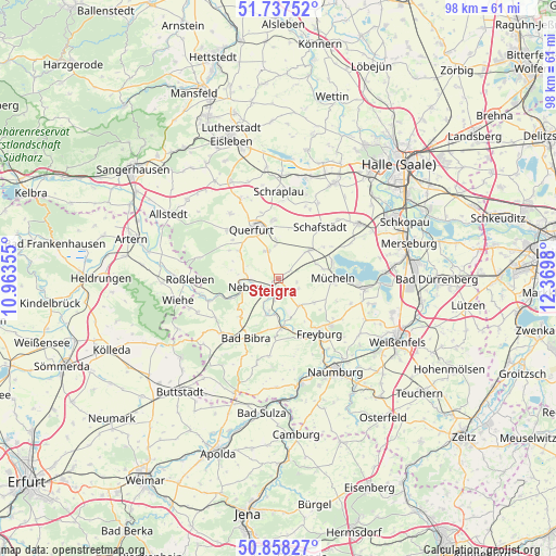
Steigra GPS coordinates[2]
51° 18' 0" North, 11° 40' 0.012" East
| Map corner | latitude | longitude |
|---|---|---|
| Upper-left | 51.73752°, | 10.96355° |
| Center: | 51.3°, | 11.66667° |
| Lower-right: | 50.85827°, | 12.3698° |
| Map W x H: | 97.8×97.8 km | = 60.8×60.8mi |
| max Lat: | 55.01917° ⇑36.8% North |
| Steigra: | 51.3° |
| min Lat: | ⇓63.2% South 47.40724° |
| min Long | Steigra | max Long |
| 5.92978° | 11.66667° | 14.98853° |
| W 76.7%⇐ | ⇒23.3% E |
Elevation
Elevation of Steigra is 216 m = 709 ft, and this is 33.1 m = 109 ft below average elevation for this country.
| Max E: |
1256 m = 4121 ft | 51.3% |
| Avg. | 249.1 m = 817 ft | |
| Steigra | 216 m = 709 ft | |
Min E: |
-5 m = -16 ft | 48.7% |
See also: Germany elevation on elevation.city.
Geographical zone
Steigra is located in North temperate zone (between Tropic of Cancer and the Arctic Circle). Distance of this North polar circle is 1697.1 km =1054.5 mi to North.| Distance of | km | miles | from Steigra |
|---|---|---|---|
| North Pole | 4303 | 2673.8 | to North |
| Arctic Circle | 1697.1 | 1054.5 | to North |
| Tropic Cancer | 3098.1 | 1925.1 | to South |
| Equator | 5704 | 3544.3 | to South |


Nearby cities:
15 places around Steigra: (largest is in red/bold)
• Altenroda
9.7 km =6 mi,  226°
226°
• Barnstädt
5.3 km =3.3 mi,  337°
337°
• Burgscheidungen
6.1 km =3.8 mi,  196°
196°
• Gleina
6 km =3.7 mi,  141°
141°
• Karsdorf
3.2 km =2 mi,  191°
191°
• Langeneichstädt
7.3 km =4.5 mi,  46°
46°
• Laucha
8.5 km =5.3 mi,  173°
173°
• Mücheln
9.8 km =6.1 mi,  92°
92°
• Nebra
6.3 km =3.9 mi,  257°
257°
• Nemsdorf-Göhrendorf
5.7 km =3.5 mi,  348°
348°
• Schmon
9.9 km =6.2 mi,  300°
300°
• Vitzenburg
6.9 km =4.3 mi,  271°
271°
• Wangen
9.1 km =5.7 mi,  248°
248°
• Weißenschirmbach
8.2 km =5.1 mi,  280°
280°
• Öchlitz
7.1 km =4.4 mi,  68°
68°
Sources, notices
• [Note1] Compared only with cities in Germany existing in our database
• [Src1] Map data: © OpenStreetMap contributors (CC-BY-SA)
• [Src2] Other city data from geonames.org with taken over terms of usage.
• [Src3] Geographical zone / Annual Mean Temperature by Robert A. Rohde @ Wikipedia
