Alterhofen geodata
Alterhofen (Bavaria) is a populated place; located in Germany in Europe/Berlin (GMT+2) time zone. With population of 3,454 people, there are 3652 cities with bigger population in this country. Compared to other cities in Germany, 84.8% of cities are located further ↑North; 89.1% of cities are located further ←West and 66.4% of cities have lower elevation than Alterhofen. Note1
Administrative division(s):
- Level 1: Bavaria
- Level 2: Lower Bavaria
- Level 3: Landkreis Straubing-Bogen
- Level 4: Aiterhofen


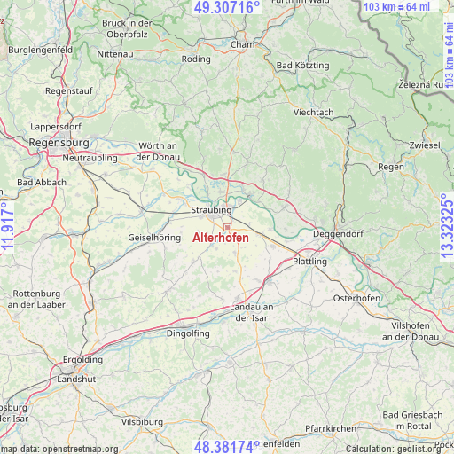
Alterhofen GPS coordinates[2]
48° 50' 47.724" North, 12° 37' 12.432" East
| Map corner | latitude | longitude |
|---|---|---|
| Upper-left | 49.30716°, | 11.917° |
| Center: | 48.84659°, | 12.62012° |
| Lower-right: | 48.38174°, | 13.32325° |
| Map W x H: | 102.9×102.9 km | = 63.9×63.9mi |
| max Lat: | 55.01917° ⇑84.8% North |
| Alterhofen: | 48.84659° |
| min Lat: | ⇓15.2% South 47.40724° |
| min Long | Alterhofen | max Long |
| 5.92978° | 12.62012° | 14.98853° |
| W 89.1%⇐ | ⇒10.9% E |
Elevation
Elevation of Alterhofen is 331 m = 1086 ft, and this is 81.9 m = 269 ft above average elevation for this country.
| Max E: |
1256 m = 4121 ft | 33.6% |
| Alterhofen | 331 m 1086 ft | |
| Avg. | 249.1 m = 817 ft | |
Min E: |
-5 m = -16 ft | 66.4% |
See also: Germany elevation on elevation.city.
Geographical zone
Alterhofen is located in North temperate zone (between Tropic of Cancer and the Arctic Circle). Distance of this North polar circle is 1969.9 km =1224 mi to North.| Distance of | km | miles | from Alterhofen |
|---|---|---|---|
| North Pole | 4575.8 | 2843.3 | to North |
| Arctic Circle | 1969.9 | 1224 | to North |
| Tropic Cancer | 2825.3 | 1755.6 | to South |
| Equator | 5431.2 | 3374.8 | to South |


Nearby cities:
15 places around Alterhofen: (largest is in red/bold)
• Atting
11 km =6.8 mi,  298°
298°
• Bogen
8.8 km =5.5 mi,  35°
35°
• Feldkirchen
6.8 km =4.2 mi,  262°
262°
• Hunderdorf
6.4 km =4 mi, 38°
• Irlbach
9.6 km =6 mi,  93°
93°
• Kirchroth
12.6 km =7.8 mi,  335°
335°
• Leiblfing
10.9 km =6.8 mi,  223°
223°
• Mariaposching
13.2 km =8.2 mi,  96°
96°
• Oberschneiding
5.9 km =3.7 mi,  164°
164°
• Parkstetten
7.9 km =4.9 mi,  349°
349°
• Rain
12.8 km =8 mi, 300°
• Salching
5.4 km =3.4 mi, 222°
• Steinach
12 km =7.5 mi,  355°
355°
• Straubing
5.1 km =3.2 mi,  318°
318°
• Straßkirchen
7.6 km =4.7 mi, 103°
Sources, notices
• [Note1] Compared only with cities in Germany existing in our database
• [Src1] Map data: © OpenStreetMap contributors (CC-BY-SA)
• [Src2] Other city data from geonames.org with taken over terms of usage.
• [Src3] Geographical zone / Annual Mean Temperature by Robert A. Rohde @ Wikipedia
