Bogen geodata
Bogen (Bavaria) is a populated place; located in Germany in Europe/Berlin (GMT+2) time zone. With population of 10,259 people, there are 1594 cities with bigger population in this country. Compared to other cities in Germany, 84% of cities are located further ↑North; 89.7% of cities are located further ←West and 64.9% of cities have lower elevation than Bogen. Note1
Administrative division(s):
- Level 1: Bavaria
- Level 2: Lower Bavaria
- Level 3: Landkreis Straubing-Bogen
- Level 4: Bogen


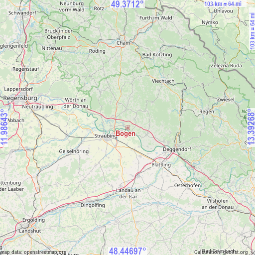
Bogen GPS coordinates[2]
48° 54' 40.392" North, 12° 41' 22.38" East
| Map corner | latitude | longitude |
|---|---|---|
| Upper-left | 49.3712°, | 11.98643° |
| Center: | 48.91122°, | 12.68955° |
| Lower-right: | 48.44697°, | 13.39268° |
| Map W x H: | 102.8×102.8 km | = 63.9×63.9mi |
| max Lat: | 55.01917° ⇑84% North |
| Bogen: | 48.91122° |
| min Lat: | ⇓16% South 47.40724° |
| min Long | Bogen | max Long |
| 5.92978° | 12.68955° | 14.98853° |
| W 89.7%⇐ | ⇒10.3% E |
Elevation
Elevation of Bogen is 320 m = 1050 ft, and this is 70.9 m = 233 ft above average elevation for this country.
| Max E: |
1256 m = 4121 ft | 35.1% |
| Bogen | 320 m 1050 ft | |
| Avg. | 249.1 m = 817 ft | |
Min E: |
-5 m = -16 ft | 64.9% |
See also: Germany elevation on elevation.city.
Geographical zone
Bogen is located in North temperate zone (between Tropic of Cancer and the Arctic Circle). Distance of this North polar circle is 1962.8 km =1219.6 mi to North.| Distance of | km | miles | from Bogen |
|---|---|---|---|
| North Pole | 4568.6 | 2838.8 | to North |
| Arctic Circle | 1962.8 | 1219.6 | to North |
| Tropic Cancer | 2832.5 | 1760 | to South |
| Equator | 5438.4 | 3379.3 | to South |


Nearby cities:
15 places around Bogen: (largest is in red/bold)
• Alterhofen
8.8 km =5.5 mi,  215°
215°
• Haselbach
10.3 km =6.4 mi,  0°
0°
• Hunderdorf
2.5 km =1.6 mi,  207°
207°
• Hunderdorf
5.4 km =3.4 mi,  36°
36°
• Irlbach
9 km =5.6 mi,  149°
149°
• Mitterfels
7.3 km =4.5 mi,  353°
353°
• Neukirchen
8.6 km =5.3 mi,  34°
34°
• Niederwinkling
8.6 km =5.3 mi,  111°
111°
• Parkstetten
6.6 km =4.1 mi,  275°
275°
• Perasdorf
9.1 km =5.7 mi,  61°
61°
• Schwarzach
8.9 km =5.5 mi,  86°
86°
• Steinach
7.7 km =4.8 mi,  308°
308°
• Straubing
9.1 km =5.7 mi,  248°
248°
• Straßkirchen
9.2 km =5.7 mi,  165°
165°
• Windberg
5.4 km =3.4 mi,  49°
49°
Sources, notices
• [Note1] Compared only with cities in Germany existing in our database
• [Src1] Map data: © OpenStreetMap contributors (CC-BY-SA)
• [Src2] Other city data from geonames.org with taken over terms of usage.
• [Src3] Geographical zone / Annual Mean Temperature by Robert A. Rohde @ Wikipedia
