Osthausen-Wülfershausen geodata
Osthausen-Wülfershausen (Thuringia) is a seat of a fourth-order administrative division; located in Germany in Europe/Berlin (GMT+2) time zone. With population of 571 people, there are 8967 cities with bigger population in this country. Compared to other cities in Germany, 55% of cities are located further ↓South; 68.1% of cities are located further ←West and 68.4% of cities have lower elevation than Osthausen-Wülfershausen. Note1
Current local time in Osthausen-Wülfershausen:
04:06 PM, TuesdayDifference from your time zone: hours


Osthausen-Wülfershausen GPS coordinates[2]
50° 51' 0" North, 11° 4' 59.988" East
| Map corner | latitude | longitude |
|---|---|---|
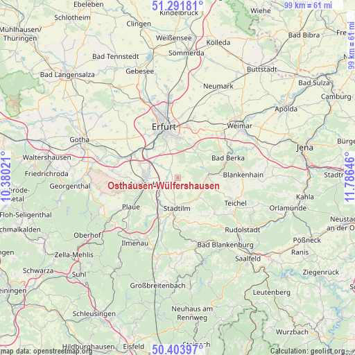
| Upper-left | 51.29181°, | 10.38021° |
| Center: | 50.85°, | 11.08333° |
| Lower-right: | 50.40397°, | 11.78646° |
| Map W x H: | 98.7×98.7 km | = 61.3×61.3mi |
| max Lat: | 55.01917° ⇑45% North |
| Osthausen-Wülfershausen: | 50.85° |
| min Lat: | ⇓55% South 47.40724° |
| min Long | Osthausen-Wülf | max Long |
| 5.92978° | 11.08333° | 14.98853° |
| W 68.1%⇐ | ⇒31.9% E |
Elevation
Elevation of Osthausen-Wülfershausen is 346 m = 1135 ft, and this is 96.9 m = 318 ft above average elevation for this country.
| Max E: |
1256 m = 4121 ft | 31.6% |
| Osthausen-Wülfershausen | 346 m 1135 ft | |
| Avg. | 249.1 m = 817 ft | |
Min E: |
-5 m = -16 ft | 68.4% |
See also: Germany elevation on elevation.city.
Geographical zone
Osthausen-Wülfershausen is located in North temperate zone (between Tropic of Cancer and the Arctic Circle). Distance of this North polar circle is 1747.2 km =1085.7 mi to North.| Distance of | km | miles | from Osthausen-Wülfershausen |
|---|---|---|---|
| North Pole | 4353.1 | 2704.9 | to North |
| Arctic Circle | 1747.2 | 1085.7 | to North |
| Tropic Cancer | 3048.1 | 1894 | to South |
| Equator | 5654 | 3513.2 | to South |


Nearby cities:
15 places around Osthausen-Wülfershausen: (largest is in red/bold)
• Alkersleben
3.5 km =2.2 mi,  270°
270°
• Barchfeld
7.2 km =4.5 mi,  109°
109°
• Bösleben-Wüllersleben
2.2 km =1.4 mi,  212°
212°
• Dornheim
6.5 km =4 mi,  255°
255°
• Elleben
1.9 km =1.2 mi,  0°
0°
• Elxleben
3 km =1.9 mi,  308°
308°
• Hohenfelden
6.3 km =3.9 mi,  59°
59°
• Ichtershausen
8.4 km =5.2 mi,  290°
290°
• Kirchheim
6 km =3.7 mi, 308°
• Klettbach
8.8 km =5.5 mi,  32°
32°
• Kranichfeld
8.2 km =5.1 mi,  86°
86°
• Nauendorf
8.5 km =5.3 mi,  54°
54°
• Rockhausen
6.5 km =4 mi,  332°
332°
• Stadtilm
8.2 km =5.1 mi,  180°
180°
• Witzleben
4.4 km =2.7 mi,  147°
147°
Sources, notices
• [Note1] Compared only with cities in Germany existing in our database
• [Src1] Map data: © OpenStreetMap contributors (CC-BY-SA)
• [Src2] Other city data from geonames.org with taken over terms of usage.
• [Src3] Geographical zone / Annual Mean Temperature by Robert A. Rohde @ Wikipedia
