Rockhausen geodata
Rockhausen (Thuringia) is a seat of a fourth-order administrative division; located in Germany in Europe/Berlin (GMT+2) time zone. With population of 277 people, there are 10143 cities with bigger population in this country. Compared to other cities in Germany, 56.1% of cities are located further ↓South; 67.5% of cities are located further ←West and 60.9% of cities have lower elevation than Rockhausen. Note1


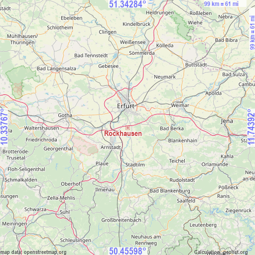
Rockhausen GPS coordinates[2]
50° 54' 5.472" North, 11° 2' 26.844" East
| Map corner | latitude | longitude |
|---|---|---|
| Upper-left | 51.34284°, | 10.33767° |
| Center: | 50.90152°, | 11.04079° |
| Lower-right: | 50.45598°, | 11.74392° |
| Map W x H: | 98.6×98.6 km | = 61.3×61.3mi |
| max Lat: | 55.01917° ⇑43.9% North |
| Rockhausen: | 50.90152° |
| min Lat: | ⇓56.1% South 47.40724° |
| min Long | Rockhausen | max Long |
| 5.92978° | 11.04079° | 14.98853° |
| W 67.5%⇐ | ⇒32.5% E |
Elevation
Elevation of Rockhausen is 295 m = 968 ft, and this is 45.9 m = 151 ft above average elevation for this country.
| Max E: |
1256 m = 4121 ft | 39.1% |
| Rockhausen | 295 m 968 ft | |
| Avg. | 249.1 m = 817 ft | |
Min E: |
-5 m = -16 ft | 60.9% |
See also: Germany elevation on elevation.city.
Geographical zone
Rockhausen is located in North temperate zone (between Tropic of Cancer and the Arctic Circle). Distance of this North polar circle is 1741.5 km =1082.1 mi to North.| Distance of | km | miles | from Rockhausen |
|---|---|---|---|
| North Pole | 4347.3 | 2701.3 | to North |
| Arctic Circle | 1741.5 | 1082.1 | to North |
| Tropic Cancer | 3053.8 | 1897.5 | to South |
| Equator | 5659.7 | 3516.8 | to South |


Nearby cities:
15 places around Rockhausen: (largest is in red/bold)
• Alkersleben
5.8 km =3.6 mi,  185°
185°
• Arnstadt
9.2 km =5.7 mi,  222°
222°
• Bösleben-Wüllersleben
7.8 km =4.8 mi,  166°
166°
• Dornheim
8.1 km =5 mi,  204°
204°
• Elleben
4.9 km =3 mi,  142°
142°
• Elxleben
3.9 km =2.4 mi, 170°
• Erfurt
8.6 km =5.3 mi,  356°
356°
• Hochheim
7.1 km =4.4 mi,  335°
335°
• Hohenfelden
8.8 km =5.5 mi,  106°
106°
• Ichtershausen
5.7 km =3.5 mi,  240°
240°
• Ingersleben
7.6 km =4.7 mi,  287°
287°
• Kirchheim
2.6 km =1.6 mi, 219°
• Klettbach
7.8 km =4.8 mi,  77°
77°
• Neudietendorf
9 km =5.6 mi,  277°
277°
• Osthausen-Wülfershausen
6.5 km =4 mi,  152°
152°
Sources, notices
• [Note1] Compared only with cities in Germany existing in our database
• [Src1] Map data: © OpenStreetMap contributors (CC-BY-SA)
• [Src2] Other city data from geonames.org with taken over terms of usage.
• [Src3] Geographical zone / Annual Mean Temperature by Robert A. Rohde @ Wikipedia
