Kreimbach-Kaulbach geodata
Kreimbach-Kaulbach (Rheinland-Pfalz) is a seat of a fourth-order administrative division; located in Germany in Europe/Berlin (GMT+2) time zone. With population of 971 people, there are 7269 cities with bigger population in this country. Compared to other cities in Germany, 74.8% of cities are located further ↑North; 84.4% of cities are located further →East and 50.1% of cities have lower elevation than Kreimbach-Kaulbach. Note1
Administrative division(s):
- Level 1: Rheinland-Pfalz
- Level 3: Landkreis Kusel
- Level 4: Kreimbach-Kaulbach


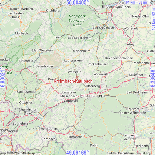
Kreimbach-Kaulbach GPS coordinates[2]
49° 33' 0" North, 7° 37' 59.988" East
| Map corner | latitude | longitude |
|---|---|---|
| Upper-left | 50.00405°, | 6.93021° |
| Center: | 49.55°, | 7.63333° |
| Lower-right: | 49.09169°, | 8.33646° |
| Map W x H: | 101.4×101.4 km | = 63×63mi |
| max Lat: | 55.01917° ⇑74.8% North |
| Kreimbach-Kaulbach: | 49.55° |
| min Lat: | ⇓25.2% South 47.40724° |
| min Long | Kreimbach-Kaulb | max Long |
| 5.92978° | 7.63333° | 14.98853° |
| W 15.6%⇐ | ⇒84.4% E |
Elevation
Elevation of Kreimbach-Kaulbach is 226 m = 741 ft, and this is 23.1 m = 76 ft below average elevation for this country.
| Max E: |
1256 m = 4121 ft | 49.9% |
| Avg. | 249.1 m = 817 ft | |
| Kreimbach-Kaulbach | 226 m = 741 ft | |
Min E: |
-5 m = -16 ft | 50.1% |
See also: Germany elevation on elevation.city.
Geographical zone
Kreimbach-Kaulbach is located in North temperate zone (between Tropic of Cancer and the Arctic Circle). Distance of this North polar circle is 1891.7 km =1175.4 mi to North.| Distance of | km | miles | from Kreimbach-Kaulbach |
|---|---|---|---|
| North Pole | 4497.6 | 2794.7 | to North |
| Arctic Circle | 1891.7 | 1175.4 | to North |
| Tropic Cancer | 2903.5 | 1804.2 | to South |
| Equator | 5509.4 | 3423.4 | to South |


Nearby cities:
15 places around Kreimbach-Kaulbach: (largest is in red/bold)
• Erzenhausen
5.7 km =3.5 mi,  192°
192°
• Eulenbis
5.6 km =3.5 mi,  180°
180°
• Eßweiler
5.1 km =3.2 mi,  280°
280°
• Frankelbach
1.9 km =1.2 mi, 180°
• Hirschhorn
4.7 km =2.9 mi,  135°
135°
• Jettenbach
5.7 km =3.5 mi,  252°
252°
• Kollweiler
5.2 km =3.2 mi,  224°
224°
• Niederkirchen
6.1 km =3.8 mi,  52°
52°
• Oberweiler-Tiefenbach
5.7 km =3.5 mi,  347°
347°
• Olsbrücken
2.2 km =1.4 mi,  124°
124°
• Relsberg
6.1 km =3.8 mi,  23°
23°
• Rothselberg
2.4 km =1.5 mi,  270°
270°
• Rutsweiler an der Lauter
2.2 km =1.4 mi,  327°
327°
• Schallodenbach
6 km =3.7 mi,  90°
90°
• Wolfstein
4.3 km =2.7 mi, 331°
Sources, notices
• [Note1] Compared only with cities in Germany existing in our database
• [Src1] Map data: © OpenStreetMap contributors (CC-BY-SA)
• [Src2] Other city data from geonames.org with taken over terms of usage.
• [Src3] Geographical zone / Annual Mean Temperature by Robert A. Rohde @ Wikipedia
