Jettenbach geodata
Jettenbach (Rheinland-Pfalz) is a seat of a fourth-order administrative division; located in Germany in Europe/Berlin (GMT+2) time zone. With population of 884 people, there are 7578 cities with bigger population in this country. Compared to other cities in Germany, 75.1% of cities are located further ↑North; 85.8% of cities are located further →East and 69.7% of cities have lower elevation than Jettenbach. Note1


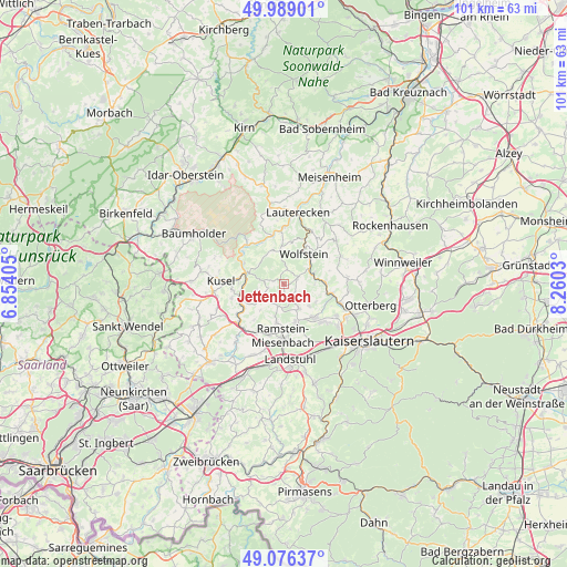
Jettenbach GPS coordinates[2]
49° 32' 5.352" North, 7° 33' 25.848" East
| Map corner | latitude | longitude |
|---|---|---|
| Upper-left | 49.98901°, | 6.85405° |
| Center: | 49.53482°, | 7.55718° |
| Lower-right: | 49.07637°, | 8.2603° |
| Map W x H: | 101.5×101.5 km | = 63.1×63.1mi |
| max Lat: | 55.01917° ⇑75.1% North |
| Jettenbach: | 49.53482° |
| min Lat: | ⇓24.9% South 47.40724° |
| min Long | Jettenbach | max Long |
| 5.92978° | 7.55718° | 14.98853° |
| W 14.2%⇐ | ⇒85.8% E |
Elevation
Elevation of Jettenbach is 356 m = 1168 ft, and this is 106.9 m = 351 ft above average elevation for this country.
| Max E: |
1256 m = 4121 ft | 30.3% |
| Jettenbach | 356 m 1168 ft | |
| Avg. | 249.1 m = 817 ft | |
Min E: |
-5 m = -16 ft | 69.7% |
See also: Germany elevation on elevation.city.
Geographical zone
Jettenbach is located in North temperate zone (between Tropic of Cancer and the Arctic Circle). Distance of this North polar circle is 1893.4 km =1176.5 mi to North.| Distance of | km | miles | from Jettenbach |
|---|---|---|---|
| North Pole | 4499.3 | 2795.7 | to North |
| Arctic Circle | 1893.4 | 1176.5 | to North |
| Tropic Cancer | 2901.8 | 1803.1 | to South |
| Equator | 5507.8 | 3422.4 | to South |


Nearby cities:
15 places around Jettenbach: (largest is in red/bold)
• Bosenbach
2 km =1.2 mi,  287°
287°
• Eßweiler
2.7 km =1.7 mi,  10°
10°
• Frankelbach
5.5 km =3.4 mi,  91°
91°
• Föckelberg
5.3 km =3.3 mi,  268°
268°
• Hinzweiler
5.4 km =3.4 mi,  354°
354°
• Horschbach
5.7 km =3.5 mi,  342°
342°
• Kollweiler
2.8 km =1.7 mi,  136°
136°
• Kreimbach-Kaulbach
5.7 km =3.5 mi,  72°
72°
• Niederstaufenbach
2.9 km =1.8 mi, 266°
• Oberstaufenbach
4 km =2.5 mi,  238°
238°
• Oberweiler im Tal
5.4 km =3.4 mi, 354°
• Reichenbach-Steegen
3.9 km =2.4 mi,  187°
187°
• Rothselberg
3.5 km =2.2 mi,  61°
61°
• Rutsweiler an der Lauter
5.6 km =3.5 mi,  50°
50°
• Schwedelbach
5.1 km =3.2 mi,  148°
148°
Sources, notices
• [Note1] Compared only with cities in Germany existing in our database
• [Src1] Map data: © OpenStreetMap contributors (CC-BY-SA)
• [Src2] Other city data from geonames.org with taken over terms of usage.
• [Src3] Geographical zone / Annual Mean Temperature by Robert A. Rohde @ Wikipedia
