Mülheim geodata
Mülheim (North Rhine-Westphalia) is a section of populated place; located in Germany in Europe/Berlin (GMT+2) time zone. With population of 41,711 people, there are 303 cities with bigger population in this country. Compared to other cities in Germany, 57.4% of cities are located further ↓South; 93.3% of cities are located further →East and 77.5% of cities have higher elevation than Mülheim. Note1
Administrative division(s):
- Level 1: North Rhine-Westphalia
- Level 2: Regierungsbezirk Köln
- Level 3: Kreisfreie Stadt Köln
- Level 4: Köln


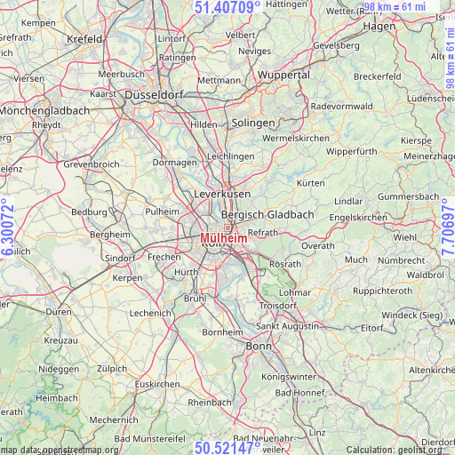
Mülheim GPS coordinates[2]
50° 57' 59.004" North, 7° 0' 13.824" East
| Map corner | latitude | longitude |
|---|---|---|
| Upper-left | 51.40709°, | 6.30072° |
| Center: | 50.96639°, | 7.00384° |
| Lower-right: | 50.52147°, | 7.70697° |
| Map W x H: | 98.5×98.5 km | = 61.2×61.2mi |
| max Lat: | 55.01917° ⇑42.6% North |
| Mülheim: | 50.96639° |
| min Lat: | ⇓57.4% South 47.40724° |
| min Long | Mülheim | max Long |
| 5.92978° | 7.00384° | 14.98853° |
| W 6.7%⇐ | ⇒93.3% E |
Elevation
Elevation of Mülheim is 54 m = 177 ft, and this is 195.1 m = 640 ft below average elevation for this country.
| Max E: |
1256 m = 4121 ft | 77.5% |
| Avg. | 249.1 m = 817 ft | |
| Mülheim | 54 m = 177 ft | |
Min E: |
-5 m = -16 ft | 22.5% |
See also: Mülheim elevation on elevation.city.
Geographical zone
Mülheim is located in North temperate zone (between Tropic of Cancer and the Arctic Circle). Distance of this North polar circle is 1734.2 km =1077.6 mi to North.| Distance of | km | miles | from Mülheim |
|---|---|---|---|
| North Pole | 4340.1 | 2696.8 | to North |
| Arctic Circle | 1734.2 | 1077.6 | to North |
| Tropic Cancer | 3061 | 1902 | to South |
| Equator | 5666.9 | 3521.2 | to South |


Nearby cities:
15 places around Mülheim: (largest is in red/bold)
• Altstadt Nord
4.5 km =2.8 mi,  226°
226°
• Altstadt Sud
4.8 km =3 mi,  220°
220°
• Bilderstoeckchen
5.2 km =3.2 mi,  274°
274°
• Buchforst
1.7 km =1.1 mi,  175°
175°
• Buchheim
2 km =1.2 mi,  144°
144°
• Deutz
4.1 km =2.5 mi,  209°
209°
• Humboldtkolonie
3.9 km =2.4 mi,  189°
189°
• Höhenberg
4.5 km =2.8 mi, 144°
• Kalk
2.9 km =1.8 mi, 176°
• Köln
5.3 km =3.3 mi, 225°
• Neuehrenfeld
4.8 km =3 mi,  258°
258°
• Neustadt/Nord
4.4 km =2.7 mi,  243°
243°
• Nippes
3.6 km =2.2 mi, 268°
• Ostheim
4.8 km =3 mi, 144°
• Riehl
2 km =1.2 mi, 271°
Sources, notices
• [Note1] Compared only with cities in Germany existing in our database
• [Src1] Map data: © OpenStreetMap contributors (CC-BY-SA)
• [Src2] Other city data from geonames.org with taken over terms of usage.
• [Src3] Geographical zone / Annual Mean Temperature by Robert A. Rohde @ Wikipedia
