Fronreute geodata
Fronreute (Baden-Württemberg) is a seat of a fourth-order administrative division; located in Germany in Europe/Berlin (GMT+2) time zone. With population of 4,478 people, there are 3047 cities with bigger population in this country. Compared to other cities in Germany, 96.9% of cities are located further ↑North; 56.7% of cities are located further →East and 93.9% of cities have lower elevation than Fronreute. Note1
Administrative division(s):
- Level 1: Baden-Württemberg
- Level 2: Tübingen Region
- Level 3: Landkreis Ravensburg
- Level 4: Fronreute


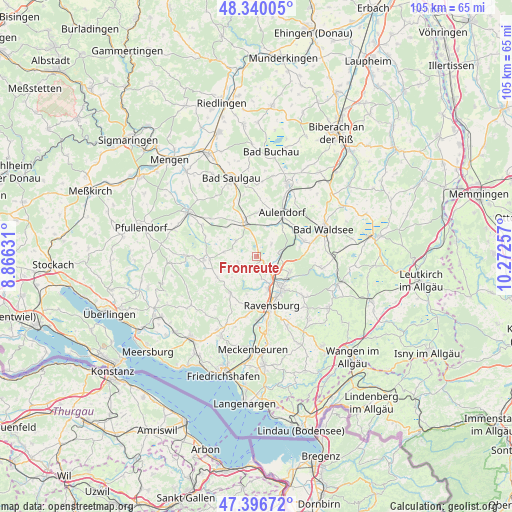
Fronreute GPS coordinates[2]
47° 52' 13.908" North, 9° 34' 9.984" East
| Map corner | latitude | longitude |
|---|---|---|
| Upper-left | 48.34005°, | 8.86631° |
| Center: | 47.87053°, | 9.56944° |
| Lower-right: | 47.39672°, | 10.27257° |
| Map W x H: | 104.9×104.9 km | = 65.2×65.2mi |
| max Lat: | 55.01917° ⇑96.9% North |
| Fronreute: | 47.87053° |
| min Lat: | ⇓3.1% South 47.40724° |
| min Long | Fronreute | max Long |
| 5.92978° | 9.56944° | 14.98853° |
| W 43.3%⇐ | ⇒56.7% E |
Elevation
Elevation of Fronreute is 572 m = 1877 ft, and this is 322.9 m = 1059 ft above average elevation for this country.
| Max E: |
1256 m = 4121 ft | 6.1% |
| Fronreute | 572 m 1877 ft | |
| Avg. | 249.1 m = 817 ft | |
Min E: |
-5 m = -16 ft | 93.9% |
See also: Germany elevation on elevation.city.
Geographical zone
Fronreute is located in North temperate zone (between Tropic of Cancer and the Arctic Circle). Distance of this North polar circle is 2078.5 km =1291.5 mi to North.| Distance of | km | miles | from Fronreute |
|---|---|---|---|
| North Pole | 4684.4 | 2910.8 | to North |
| Arctic Circle | 2078.5 | 1291.5 | to North |
| Tropic Cancer | 2716.8 | 1688.1 | to South |
| Equator | 5322.7 | 3307.4 | to South |


Nearby cities:
15 places around Fronreute: (largest is in red/bold)
• Altshausen
7.5 km =4.7 mi,  338°
338°
• Aulendorf
10.3 km =6.4 mi,  29°
29°
• Baienfurt
7.7 km =4.8 mi,  127°
127°
• Baindt
7.6 km =4.7 mi,  107°
107°
• Berg
6.4 km =4 mi,  159°
159°
• Ebenweiler
5.1 km =3.2 mi,  309°
309°
• Ebersbach-Musbach
10.7 km =6.6 mi,  5°
5°
• Eichstegen
8.7 km =5.4 mi,  323°
323°
• Fleischwangen
6.6 km =4.1 mi,  282°
282°
• Guggenhausen
9.5 km =5.9 mi,  290°
290°
• Horgenzell
9 km =5.6 mi,  216°
216°
• Ravensburg
10.3 km =6.4 mi, 162°
• Unterwaldhausen
8.3 km =5.2 mi, 293°
• Weingarten
8.5 km =5.3 mi,  142°
142°
• Wolpertswende
4.2 km =2.6 mi,  49°
49°
Sources, notices
• [Note1] Compared only with cities in Germany existing in our database
• [Src1] Map data: © OpenStreetMap contributors (CC-BY-SA)
• [Src2] Other city data from geonames.org with taken over terms of usage.
• [Src3] Geographical zone / Annual Mean Temperature by Robert A. Rohde @ Wikipedia
