Nykøbing Sjælland geodata
Nykøbing Sjælland (Zealand) is a populated place; located in Denmark in Europe/Copenhagen (GMT+2) time zone. With population of 5,596 people, there are 121 cities with bigger population in this country. Compared to other cities in Denmark, 61.4% of cities are located further ↓South; 69% of cities are located further ←West and 63.2% of cities have higher elevation than Nykøbing Sjælland. Note1


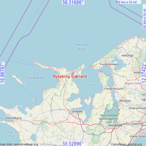
Nykøbing Sjælland GPS coordinates[2]
55° 55' 29.676" North, 11° 40' 15.924" East
| Map corner | latitude | longitude |
|---|---|---|
| Upper-left | 56.31686°, | 10.96797° |
| Center: | 55.92491°, | 11.67109° |
| Lower-right: | 55.52896°, | 12.37422° |
| Map W x H: | 87.6×87.6 km | = 54.4×54.4mi |
| max Lat: | 57.72093° ⇑38.6% North |
| Nykøbing Sjælland: | 55.92491° |
| min Lat: | ⇓61.4% South 54.57644° |
| min Long | Nykøbing Sjæl | max Long |
| 8.12605° | 11.67109° | 15.18662° |
| W 69%⇐ | ⇒31% E |
Elevation
Elevation of Nykøbing Sjælland is 15 m = 49 ft, and this is 12.3 m = 40 ft below average elevation for this country.
| Max E: |
114 m = 374 ft | 63.2% |
| Avg. | 27.3 m = 90 ft | |
| Nykøbing Sjælland | 15 m = 49 ft | |
Min E: |
0 m = 0 ft | 36.8% |
See also: Denmark elevation on elevation.city.
Geographical zone
Nykøbing Sjælland is located in North temperate zone (between Tropic of Cancer and the Arctic Circle). Distance of this North polar circle is 1182.9 km =735 mi to North.| Distance of | km | miles | from Nykøbing Sjælland |
|---|---|---|---|
| North Pole | 3788.8 | 2354.3 | to North |
| Arctic Circle | 1182.9 | 735 | to North |
| Tropic Cancer | 3612.3 | 2244.6 | to South |
| Equator | 6218.3 | 3863.9 | to South |


Nearby cities:
15 places around Nykøbing Sjælland: (largest is in red/bold)
• Asnæs
16.4 km =10.2 mi,  220°
220°
• Ejby
28.4 km =17.6 mi,  157°
157°
• Frederikssund
26.6 km =16.5 mi,  110°
110°
• Frederiksværk
22.5 km =14 mi,  76°
76°
• Holbæk
23.2 km =14.4 mi,  173°
173°
• Hundested
12 km =7.5 mi,  68°
68°
• Højby
4.8 km =3 mi,  251°
251°
• Hørve
23.5 km =14.6 mi, 215°
• Jægerspris
21.2 km =13.2 mi, 112°
• Liseleje
20.8 km =12.9 mi,  61°
61°
• Skibby
26.5 km =16.5 mi,  136°
136°
• Skævinge
29.9 km =18.6 mi,  93°
93°
• Slangerup
33 km =20.5 mi,  104°
104°
• Svinninge
26 km =16.2 mi,  209°
209°
• Vipperød
28.9 km =18 mi, 171°
Sources, notices
• [Note1] Compared only with cities in Denmark existing in our database
• [Src1] Map data: © OpenStreetMap contributors (CC-BY-SA)
• [Src2] Other city data from geonames.org with taken over terms of usage.
• [Src3] Geographical zone / Annual Mean Temperature by Robert A. Rohde @ Wikipedia
