Faxe Ladeplads geodata
Faxe Ladeplads (Zealand) is a populated place; located in Denmark in Europe/Copenhagen (GMT+2) time zone. With population of 2,837 people, there are 225 cities with bigger population in this country. Compared to other cities in Denmark, 86.5% of cities are located further ↑North; 81.6% of cities are located further ←West and 78.9% of cities have higher elevation than Faxe Ladeplads. Note1


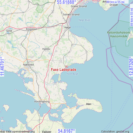
Faxe Ladeplads GPS coordinates[2]
55° 13' 11.316" North, 12° 10' 12.468" East
| Map corner | latitude | longitude |
|---|---|---|
| Upper-left | 55.61888°, | 11.46701° |
| Center: | 55.21981°, | 12.17013° |
| Lower-right: | 54.8167°, | 12.87326° |
| Map W x H: | 89.2×89.2 km | = 55.4×55.4mi |
| max Lat: | 57.72093° ⇑86.5% North |
| Faxe Ladeplads: | 55.21981° |
| min Lat: | ⇓13.5% South 54.57644° |
| min Long | Faxe Ladeplads | max Long |
| 8.12605° | 12.17013° | 15.18662° |
| W 81.6%⇐ | ⇒18.4% E |
Elevation
Elevation of Faxe Ladeplads is 9 m = 30 ft, and this is 18.3 m = 60 ft below average elevation for this country.
| Max E: |
114 m = 374 ft | 78.9% |
| Avg. | 27.3 m = 90 ft | |
| Faxe Ladeplads | 9 m = 30 ft | |
Min E: |
0 m = 0 ft | 21.1% |
See also: Denmark elevation on elevation.city.
Geographical zone
Faxe Ladeplads is located in North temperate zone (between Tropic of Cancer and the Arctic Circle). Distance of this North polar circle is 1261.3 km =783.7 mi to North.| Distance of | km | miles | from Faxe Ladeplads |
|---|---|---|---|
| North Pole | 3867.2 | 2403 | to North |
| Arctic Circle | 1261.3 | 783.7 | to North |
| Tropic Cancer | 3533.9 | 2195.9 | to South |
| Equator | 6139.9 | 3815.2 | to South |


Nearby cities:
15 places around Faxe Ladeplads: (largest is in red/bold)
• Faxe
5.1 km =3.2 mi,  320°
320°
• Fensmark
24.1 km =15 mi,  285°
285°
• Haslev
17.4 km =10.8 mi,  311°
311°
• Hårlev
15 km =9.3 mi,  15°
15°
• Køge
26.5 km =16.5 mi,  1°
1°
• Neder Vindinge
27.7 km =17.2 mi,  221°
221°
• Nyråd
27.3 km =17 mi,  209°
209°
• Næstved
26 km =16.2 mi,  272°
272°
• Præstø
13.3 km =8.3 mi, 216°
• Rødvig
13.8 km =8.6 mi,  73°
73°
• Rønnede
10.3 km =6.4 mi, 293°
• Stege
26.9 km =16.7 mi,  164°
164°
• Store Heddinge
17.1 km =10.6 mi,  54°
54°
• Strøby Egede
22.1 km =13.7 mi,  12°
12°
• Ørslev
23.4 km =14.5 mi, 213°
Sources, notices
• [Note1] Compared only with cities in Denmark existing in our database
• [Src1] Map data: © OpenStreetMap contributors (CC-BY-SA)
• [Src2] Other city data from geonames.org with taken over terms of usage.
• [Src3] Geographical zone / Annual Mean Temperature by Robert A. Rohde @ Wikipedia
