Postrer Río geodata
Postrer Río (Independencia) is a populated place; located in Dominican Republic in America/Santo_Domingo (GMT-4) time zone. With population of 3,078 people, there are 144 cities with bigger population in this country. Compared to other cities in Dominican Republic, 69.2% of cities are located further ↑North; 94.3% of cities are located further →East and 85.8% of cities have higher elevation than Postrer Río. Note1
Administrative division(s):
- Level 1: Independencia
- Level 2: Postrer Río
- Level 3: Postrer Río
- Level 4: Postrer Río (Zona Urbana)


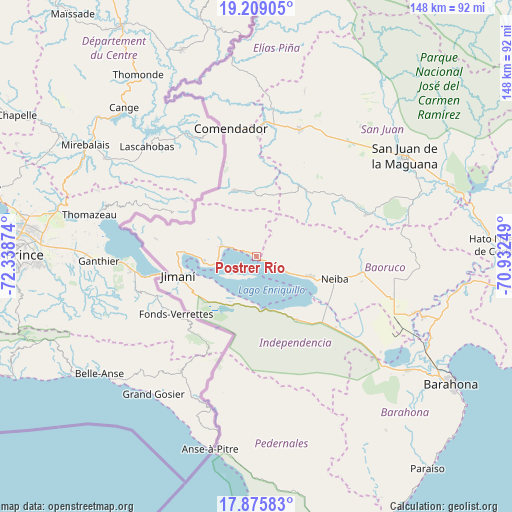
Postrer Río GPS coordinates[2]
18° 32' 37.464" North, 71° 38' 8.196" West
| Map corner | latitude | longitude |
|---|---|---|
| Upper-left | 19.20905°, | -72.33874° |
| Center: | 18.54374°, | -71.63561° |
| Lower-right: | 17.87583°, | -70.93249° |
| Map W x H: | 148.2×148.2 km | = 92.1×92.1mi |
| max Lat: | 19.89131° ⇑69.2% North |
| Postrer Río: | 18.54374° |
| min Lat: | ⇓30.8% South 17.80136° |
| min Long | Postrer Río | max Long |
| -71.85022° | -71.63561° | -68.40431° |
| W 5.7%⇐ | ⇒94.3% E |
Elevation
Elevation of Postrer Río is 16 m = 52 ft, and this is 150.3 m = 493 ft below average elevation for this country.
| Max E: |
1242 m = 4075 ft | 85.8% |
| Avg. | 166.3 m = 546 ft | |
| Postrer Río | 16 m = 52 ft | |
Min E: |
5 m = 16 ft | 14.2% |
See also: Dominican Republic elevation on elevation.city.
Geographical zone
Postrer Río is located in North Torrid zone (between Equator and Tropic of Cancer). Distance of this Northern Tropic circle is 544 km =338 mi to North.| Distance of | km | miles | from Postrer Río |
|---|---|---|---|
| North Pole | 7945.2 | 4936.9 | to North |
| Arctic Circle | 5339.3 | 3317.7 | to North |
| Tropic Cancer | 544 | 338 | to North |
| Equator | 2061.9 | 1281.2 | to South |


Nearby cities:
15 places around Postrer Río: (largest is in red/bold)
• Cercado Abajo
23.9 km =14.9 mi,  31°
31°
• Comendador
37.8 km =23.5 mi,  349°
349°
• Duvergé
21.8 km =13.5 mi,  147°
147°
• El Llano
30.3 km =18.8 mi,  0°
0°
• Galván
31.2 km =19.4 mi,  98°
98°
• Guayabal
6.1 km =3.8 mi, 353°
• Hondo Valle
20.2 km =12.6 mi,  341°
341°
• Jimaní
23.4 km =14.5 mi,  255°
255°
• Juan Santiago
18.4 km =11.4 mi,  15°
15°
• La Descubierta
10.4 km =6.5 mi,  286°
286°
• Los Ríos
5.3 km =3.3 mi,  117°
117°
• Mella
30.9 km =19.2 mi,  131°
131°
• Neiba
23.8 km =14.8 mi,  106°
106°
• Vallejuelo
34 km =21.1 mi,  68°
68°
• Villa Jaragua
17.1 km =10.6 mi, 110°
Sources, notices
• [Note1] Compared only with cities in Dominican Republic existing in our database
• [Src1] Map data: © OpenStreetMap contributors (CC-BY-SA)
• [Src2] Other city data from geonames.org with taken over terms of usage.
• [Src3] Geographical zone / Annual Mean Temperature by Robert A. Rohde @ Wikipedia
