Hondo Valle geodata
Hondo Valle (Elías Piña) is a populated place; located in Dominican Republic in America/Santo_Domingo (GMT-4) time zone. With population of 3,713 people, there are 137 cities with bigger population in this country. Compared to other cities in Dominican Republic, 60.2% of cities are located further ↑North; 96.7% of cities are located further →East and 98.6% of cities have lower elevation than Hondo Valle. Note1
Administrative division(s):
- Level 1: Elías Piña
- Level 2: Hondo Valle
- Level 3: Hondo Valle
- Level 4: Hondo Valle (Zona Urbana)


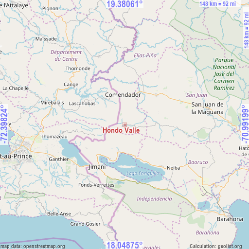
Hondo Valle GPS coordinates[2]
18° 42' 57.564" North, 71° 41' 42.396" West
| Map corner | latitude | longitude |
|---|---|---|
| Upper-left | 19.38061°, | -72.39824° |
| Center: | 18.71599°, | -71.69511° |
| Lower-right: | 18.04875°, | -70.99199° |
| Map W x H: | 148.1×148.1 km | = 92×92mi |
| max Lat: | 19.89131° ⇑60.2% North |
| Hondo Valle: | 18.71599° |
| min Lat: | ⇓39.8% South 17.80136° |
| min Long | Hondo Valle | max Long |
| -71.85022° | -71.69511° | -68.40431° |
| W 3.3%⇐ | ⇒96.7% E |
Elevation
Elevation of Hondo Valle is 899 m = 2949 ft, and this is 732.7 m = 2404 ft above average elevation for this country.
| Max E: |
1242 m = 4075 ft | 1.4% |
| Hondo Valle | 899 m 2949 ft | |
| Avg. | 166.3 m = 546 ft | |
Min E: |
5 m = 16 ft | 98.6% |
See also: Dominican Republic elevation on elevation.city.
Geographical zone
Hondo Valle is located in North Torrid zone (between Equator and Tropic of Cancer). Distance of this Northern Tropic circle is 524.9 km =326.2 mi to North.| Distance of | km | miles | from Hondo Valle |
|---|---|---|---|
| North Pole | 7926 | 4925 | to North |
| Arctic Circle | 5320.2 | 3305.8 | to North |
| Tropic Cancer | 524.9 | 326.2 | to North |
| Equator | 2081 | 1293.1 | to South |


Nearby cities:
15 places around Hondo Valle: (largest is in red/bold)
• Cercado Abajo
18.8 km =11.7 mi,  86°
86°
• Comendador
18 km =11.2 mi,  357°
357°
• El Llano
12.9 km =8 mi,  30°
30°
• Guayabal
14.3 km =8.9 mi,  156°
156°
• Jimaní
29.8 km =18.5 mi,  213°
213°
• Juan Santiago
11.2 km =7 mi,  97°
97°
• La Descubierta
16.6 km =10.3 mi,  192°
192°
• Las Matas de Farfán
25.7 km =16 mi,  47°
47°
• Los Ríos
24.3 km =15.1 mi,  153°
153°
• Matayaya
22.1 km =13.7 mi, 28°
• Neiba
39 km =24.2 mi,  131°
131°
• Pedro Corto
33.4 km =20.8 mi,  63°
63°
• Postrer Río
20.2 km =12.6 mi, 161°
• Vallejuelo
38.6 km =24 mi, 100°
• Villa Jaragua
33.5 km =20.8 mi,  138°
138°
Sources, notices
• [Note1] Compared only with cities in Dominican Republic existing in our database
• [Src1] Map data: © OpenStreetMap contributors (CC-BY-SA)
• [Src2] Other city data from geonames.org with taken over terms of usage.
• [Src3] Geographical zone / Annual Mean Temperature by Robert A. Rohde @ Wikipedia
