Palmar de Ocoa geodata
Palmar de Ocoa (Azua) is a populated place; located in Dominican Republic in America/Santo_Domingo (GMT-4) time zone. With population of 1,997 people, there are 175 cities with bigger population in this country. Compared to other cities in Dominican Republic, 90% of cities are located further ↑North; 50.7% of cities are located further ←West and 100% of cities have higher elevation than Palmar de Ocoa. Note1
Administrative division(s):
- Level 1: Azua
- Level 2: Las Charcas
- Level 3: Palmar De Ocoa (D. M.).
- Level 4: Palmar De Ocoa (Zona Urbana)


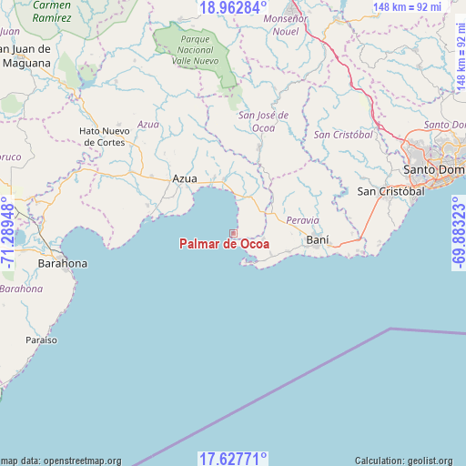
Palmar de Ocoa GPS coordinates[2]
18° 17' 47.616" North, 70° 35' 10.86" West
| Map corner | latitude | longitude |
|---|---|---|
| Upper-left | 18.96284°, | -71.28948° |
| Center: | 18.29656°, | -70.58635° |
| Lower-right: | 17.62771°, | -69.88323° |
| Map W x H: | 148.5×148.5 km | = 92.3×92.3mi |
| max Lat: | 19.89131° ⇑90% North |
| Palmar de Ocoa: | 18.29656° |
| min Lat: | ⇓10% South 17.80136° |
| min Long | Palmar de Ocoa | max Long |
| -71.85022° | -70.58635° | -68.40431° |
| W 50.7%⇐ | ⇒49.3% E |
Elevation
Elevation of Palmar de Ocoa is 5 m = 16 ft, and this is 161.3 m = 529 ft below average elevation for this country.
| Max E: |
1242 m = 4075 ft | 100% |
| Avg. | 166.3 m = 546 ft | |
| Palmar de Ocoa | 5 m = 16 ft | |
Min E: |
5 m = 16 ft | 0% |
See also: Dominican Republic elevation on elevation.city.
Geographical zone
Palmar de Ocoa is located in North Torrid zone (between Equator and Tropic of Cancer). Distance of this Northern Tropic circle is 571.5 km =355.1 mi to North.| Distance of | km | miles | from Palmar de Ocoa |
|---|---|---|---|
| North Pole | 7972.7 | 4954 | to North |
| Arctic Circle | 5366.8 | 3334.8 | to North |
| Tropic Cancer | 571.5 | 355.1 | to North |
| Equator | 2034.4 | 1264.1 | to South |


Nearby cities:
15 places around Palmar de Ocoa: (largest is in red/bold)
• Azua
23.4 km =14.5 mi,  318°
318°
• Baní
26.9 km =16.7 mi,  94°
94°
• El Cacao
40 km =24.9 mi,  50°
50°
• Estebanía
18.9 km =11.7 mi,  341°
341°
• Las Charcas
17.4 km =10.8 mi,  349°
349°
• Matanzas
18.8 km =11.7 mi,  108°
108°
• Nizao
40.1 km =24.9 mi,  97°
97°
• Paya
30.9 km =19.2 mi, 97°
• Peralta
37.2 km =23.1 mi,  328°
328°
• Pizarrete
38 km =23.6 mi, 89°
• Pueblo Viejo
22.3 km =13.9 mi,  301°
301°
• Sabana Buey
7.1 km =4.4 mi, 111°
• San José de Ocoa
29.1 km =18.1 mi,  16°
16°
• Tábara Arriba
43.4 km =27 mi,  314°
314°
• Yaguate
43 km =26.7 mi,  84°
84°
Sources, notices
• [Note1] Compared only with cities in Dominican Republic existing in our database
• [Src1] Map data: © OpenStreetMap contributors (CC-BY-SA)
• [Src2] Other city data from geonames.org with taken over terms of usage.
• [Src3] Geographical zone / Annual Mean Temperature by Robert A. Rohde @ Wikipedia
