El Guayabal geodata
El Guayabal (Azua) is a populated place; located in Dominican Republic in America/Santo_Domingo (GMT-4) time zone. With population of 2,835 people, there are 149 cities with bigger population in this country. Compared to other cities in Dominican Republic, 57.8% of cities are located further ↑North; 60.2% of cities are located further →East and 96.2% of cities have lower elevation than El Guayabal. Note1
Administrative division(s):
- Level 1: Azua
- Level 2: Guayabal
- Level 3: Guayabal
- Level 4: Guayabal (Zona Urbana)


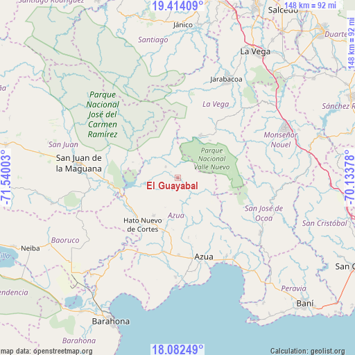
El Guayabal GPS coordinates[2]
18° 44' 58.56" North, 70° 50' 12.84" West
| Map corner | latitude | longitude |
|---|---|---|
| Upper-left | 19.41409°, | -71.54003° |
| Center: | 18.7496°, | -70.8369° |
| Lower-right: | 18.08249°, | -70.13378° |
| Map W x H: | 148.1×148.1 km | = 92×92mi |
| max Lat: | 19.89131° ⇑57.8% North |
| El Guayabal: | 18.7496° |
| min Lat: | ⇓42.2% South 17.80136° |
| min Long | El Guayabal | max Long |
| -71.85022° | -70.8369° | -68.40431° |
| W 39.8%⇐ | ⇒60.2% E |
Elevation
Elevation of El Guayabal is 727 m = 2385 ft, and this is 560.7 m = 1840 ft above average elevation for this country.
| Max E: |
1242 m = 4075 ft | 3.8% |
| El Guayabal | 727 m 2385 ft | |
| Avg. | 166.3 m = 546 ft | |
Min E: |
5 m = 16 ft | 96.2% |
See also: Dominican Republic elevation on elevation.city.
Geographical zone
El Guayabal is located in North Torrid zone (between Equator and Tropic of Cancer). Distance of this Northern Tropic circle is 521.2 km =323.9 mi to North.| Distance of | km | miles | from El Guayabal |
|---|---|---|---|
| North Pole | 7922.3 | 4922.7 | to North |
| Arctic Circle | 5316.4 | 3303.5 | to North |
| Tropic Cancer | 521.2 | 323.9 | to North |
| Equator | 2084.8 | 1295.4 | to South |


Nearby cities:
15 places around El Guayabal: (largest is in red/bold)
• Azua
34.7 km =21.6 mi,  161°
161°
• Bohechío
16.3 km =10.1 mi,  280°
280°
• Constanza
20.2 km =12.6 mi,  28°
28°
• Estebanía
38.3 km =23.8 mi,  147°
147°
• Las Charcas
40.5 km =25.2 mi, 145°
• Padre Las Casas
11 km =6.8 mi,  259°
259°
• Peralta
20 km =12.4 mi, 159°
• Pueblo Viejo
39.6 km =24.6 mi,  169°
169°
• Sabana Yegua
19.3 km =12 mi, 259°
• San José de Ocoa
41.5 km =25.8 mi,  122°
122°
• San Juan de la Maguana
41.8 km =26 mi, 278°
• Tireo Arriba
25.9 km =16.1 mi,  37°
37°
• Tábara Arriba
20.5 km =12.7 mi,  192°
192°
• Villarpando
23.6 km =14.7 mi,  244°
244°
• Yayas de Viajama
18.5 km =11.5 mi,  211°
211°
Sources, notices
• [Note1] Compared only with cities in Dominican Republic existing in our database
• [Src1] Map data: © OpenStreetMap contributors (CC-BY-SA)
• [Src2] Other city data from geonames.org with taken over terms of usage.
• [Src3] Geographical zone / Annual Mean Temperature by Robert A. Rohde @ Wikipedia
