Puurmani geodata
Puurmani (Jõgevamaa) is a populated place; located in Estonia in Europe/Tallinn (GMT+3) time zone. With population of 646 people, there are 129 cities with bigger population in this country. Compared to other cities in Estonia, 62.1% of cities are located further ↑North; 66.8% of cities are located further ←West and 54.7% of cities have lower elevation than Puurmani. Note1


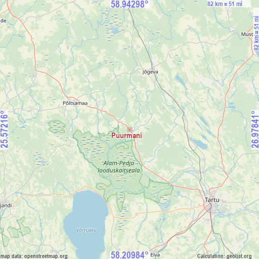
Puurmani GPS coordinates[2]
58° 34' 41.988" North, 26° 16' 31.008" East
| Map corner | latitude | longitude |
|---|---|---|
| Upper-left | 58.94298°, | 25.57216° |
| Center: | 58.57833°, | 26.27528° |
| Lower-right: | 58.20984°, | 26.97841° |
| Map W x H: | 81.5×81.5 km | = 50.6×50.6mi |
| max Lat: | 59.57639° ⇑62.1% North |
| Puurmani: | 58.57833° |
| min Lat: | ⇓37.9% South 57.72778° |
| min Long | Puurmani | max Long |
| 22.24646° | 26.27528° | 28.19028° |
| W 66.8%⇐ | ⇒33.2% E |
Elevation
Elevation of Puurmani is 57 m = 187 ft, and this is 3.8 m = 12 ft above average elevation for this country.
| Max E: |
141 m = 463 ft | 45.3% |
| Puurmani | 57 m 187 ft | |
| Avg. | 53.2 m = 175 ft | |
Min E: |
6 m = 20 ft | 54.7% |
See also: Estonia elevation on elevation.city.
Geographical zone
Puurmani is located in North temperate zone (between Tropic of Cancer and the Arctic Circle). Distance of this North polar circle is 887.9 km =551.7 mi to North.| Distance of | km | miles | from Puurmani |
|---|---|---|---|
| North Pole | 3493.8 | 2170.9 | to North |
| Arctic Circle | 887.9 | 551.7 | to North |
| Tropic Cancer | 3907.4 | 2427.9 | to South |
| Equator | 6513.3 | 4047.2 | to South |


Nearby cities:
15 places around Puurmani: (largest is in red/bold)
• Adavere
26 km =16.2 mi,  303°
303°
• Ilmatsalu
26.5 km =16.5 mi,  143°
143°
• Jõgeva
19.9 km =12.4 mi,  20°
20°
• Kuremaa
22.7 km =14.1 mi,  39°
39°
• Kõrveküla
34.1 km =21.2 mi,  120°
120°
• Lohkva
38.3 km =23.8 mi,  127°
127°
• Nõo
37 km =23 mi,  155°
155°
• Palamuse
21.2 km =13.2 mi,  55°
55°
• Puhja
26.4 km =16.4 mi,  175°
175°
• Põltsamaa
19.5 km =12.1 mi, 295°
• Siimusti
17.2 km =10.7 mi,  12°
12°
• Tartu
34.2 km =21.3 mi, 130°
• Torma
37.4 km =23.2 mi,  45°
45°
• Võisiku
21.3 km =13.2 mi,  285°
285°
• Ülenurme
39.2 km =24.4 mi, 138°
Sources, notices
• [Note1] Compared only with cities in Estonia existing in our database
• [Src1] Map data: © OpenStreetMap contributors (CC-BY-SA)
• [Src2] Other city data from geonames.org with taken over terms of usage.
• [Src3] Geographical zone / Annual Mean Temperature by Robert A. Rohde @ Wikipedia
