Kunda geodata
Kunda (Lääne-Virumaa) is a populated place; located in Estonia in Europe/Tallinn (GMT+3) time zone. With population of 3,996 people, there are 29 cities with bigger population in this country. Compared to other cities in Estonia, 95.3% of cities are located further ↓South; 73.7% of cities are located further ←West and 61.6% of cities have higher elevation than Kunda. Note1


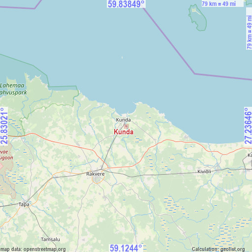
Kunda GPS coordinates[2]
59° 28' 59.988" North, 26° 31' 59.988" East
| Map corner | latitude | longitude |
|---|---|---|
| Upper-left | 59.83849°, | 25.83021° |
| Center: | 59.48333°, | 26.53333° |
| Lower-right: | 59.1244°, | 27.23646° |
| Map W x H: | 79.4×79.4 km | = 49.3×49.3mi |
| max Lat: | 59.57639° ⇑4.7% North |
| Kunda: | 59.48333° |
| min Lat: | ⇓95.3% South 57.72778° |
| min Long | Kunda | max Long |
| 22.24646° | 26.53333° | 28.19028° |
| W 73.7%⇐ | ⇒26.3% E |
Elevation
Elevation of Kunda is 46 m = 151 ft, and this is 7.2 m = 24 ft below average elevation for this country.
| Max E: |
141 m = 463 ft | 61.6% |
| Avg. | 53.2 m = 175 ft | |
| Kunda | 46 m = 151 ft | |
Min E: |
6 m = 20 ft | 38.4% |
See also: Estonia elevation on elevation.city.
Geographical zone
Kunda is located in North temperate zone (between Tropic of Cancer and the Arctic Circle). Distance of this North polar circle is 787.2 km =489.1 mi to North.| Distance of | km | miles | from Kunda |
|---|---|---|---|
| North Pole | 3393.1 | 2108.4 | to North |
| Arctic Circle | 787.2 | 489.1 | to North |
| Tropic Cancer | 4008 | 2490.5 | to South |
| Equator | 6613.9 | 4109.7 | to South |


Nearby cities:
15 places around Kunda: (largest is in red/bold)
• Aseri
19.2 km =11.9 mi,  100°
100°
• Haljala
16.3 km =10.1 mi,  250°
250°
• Hulja
23.2 km =14.4 mi,  231°
231°
• Kadrina
27.5 km =17.1 mi, 233°
• Kiviõli
28.7 km =17.8 mi,  120°
120°
• Kohtla-Nõmme
39.1 km =24.3 mi,  111°
111°
• Kunda
1.7 km =1.1 mi,  346°
346°
• Pajusti
24 km =14.9 mi,  195°
195°
• Püssi
32.3 km =20.1 mi, 115°
• Rakvere
18.2 km =11.3 mi,  213°
213°
• Roela
35 km =21.7 mi,  173°
173°
• Sonda
23.1 km =14.4 mi,  132°
132°
• Sõmeru
14.6 km =9.1 mi, 201°
• Vaiatu
33.6 km =20.9 mi,  244°
244°
• Vinni
21.6 km =13.4 mi, 195°
Sources, notices
• [Note1] Compared only with cities in Estonia existing in our database
• [Src1] Map data: © OpenStreetMap contributors (CC-BY-SA)
• [Src2] Other city data from geonames.org with taken over terms of usage.
• [Src3] Geographical zone / Annual Mean Temperature by Robert A. Rohde @ Wikipedia
