Harku geodata
Harku (Harjumaa) is a populated place; located in Estonia in Europe/Tallinn (GMT+3) time zone. With population of 781 people, there are 113 cities with bigger population in this country. Compared to other cities in Estonia, 62.6% of cities are located further ↓South; 85.3% of cities are located further →East and 50.5% of cities have lower elevation than Harku. Note1


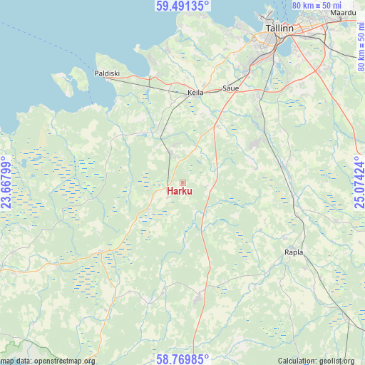
Harku GPS coordinates[2]
59° 7' 57" North, 24° 22' 15.996" East
| Map corner | latitude | longitude |
|---|---|---|
| Upper-left | 59.49135°, | 23.66799° |
| Center: | 59.1325°, | 24.37111° |
| Lower-right: | 58.76985°, | 25.07424° |
| Map W x H: | 80.2×80.2 km | = 49.8×49.8mi |
| max Lat: | 59.57639° ⇑37.4% North |
| Harku: | 59.1325° |
| min Lat: | ⇓62.6% South 57.72778° |
| min Long | Harku | max Long |
| 22.24646° | 24.37111° | 28.19028° |
| W 14.7%⇐ | ⇒85.3% E |
Elevation
Elevation of Harku is 54 m = 177 ft, and this is 0.8 m = 3 ft above average elevation for this country.
| Max E: |
141 m = 463 ft | 49.5% |
| Harku | 54 m 177 ft | |
| Avg. | 53.2 m = 175 ft | |
Min E: |
6 m = 20 ft | 50.5% |
See also: Estonia elevation on elevation.city.
Geographical zone
Harku is located in North temperate zone (between Tropic of Cancer and the Arctic Circle). Distance of this North polar circle is 826.3 km =513.4 mi to North.| Distance of | km | miles | from Harku |
|---|---|---|---|
| North Pole | 3432.1 | 2132.6 | to North |
| Arctic Circle | 826.3 | 513.4 | to North |
| Tropic Cancer | 3969 | 2466.2 | to South |
| Equator | 6574.9 | 4085.5 | to South |


Nearby cities:
15 places around Harku: (largest is in red/bold)
• Alu
25.4 km =15.8 mi,  118°
118°
• Keila
19.2 km =11.9 mi,  7°
7°
• Kiisa
21.5 km =13.4 mi,  57°
57°
• Klooga
22.7 km =14.1 mi,  336°
336°
• Kohila
22.4 km =13.9 mi,  79°
79°
• Lehola
18.1 km =11.2 mi,  349°
349°
• Märjamaa
25.6 km =15.9 mi,  172°
172°
• Orgita
22.9 km =14.2 mi, 171°
• Rapla
27.8 km =17.3 mi, 120°
• Riisipere
4 km =2.5 mi,  239°
239°
• Saku
25.3 km =15.7 mi,  41°
41°
• Saue
23.4 km =14.5 mi,  25°
25°
• Turba
10 km =6.2 mi, 236°
• Vasalemma
13.2 km =8.2 mi, 339°
• Ääsmäe
14.5 km =9 mi, 34°
Sources, notices
• [Note1] Compared only with cities in Estonia existing in our database
• [Src1] Map data: © OpenStreetMap contributors (CC-BY-SA)
• [Src2] Other city data from geonames.org with taken over terms of usage.
• [Src3] Geographical zone / Annual Mean Temperature by Robert A. Rohde @ Wikipedia
