Ardu geodata
Ardu (Harjumaa) is a populated place; located in Estonia in Europe/Tallinn (GMT+3) time zone. With population of 559 people, there are 151 cities with bigger population in this country. Compared to other cities in Estonia, 60.5% of cities are located further ↓South; 53.2% of cities are located further →East and 79.5% of cities have lower elevation than Ardu. Note1


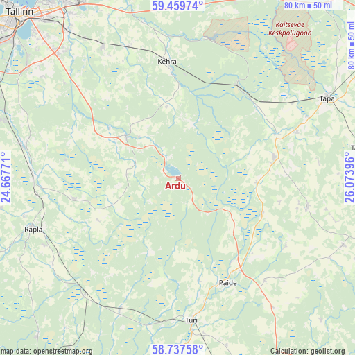
Ardu GPS coordinates[2]
59° 6' 2.016" North, 25° 22' 14.988" East
| Map corner | latitude | longitude |
|---|---|---|
| Upper-left | 59.45974°, | 24.66771° |
| Center: | 59.10056°, | 25.37083° |
| Lower-right: | 58.73758°, | 26.07396° |
| Map W x H: | 80.3×80.3 km | = 49.9×49.9mi |
| max Lat: | 59.57639° ⇑39.5% North |
| Ardu: | 59.10056° |
| min Lat: | ⇓60.5% South 57.72778° |
| min Long | Ardu | max Long |
| 22.24646° | 25.37083° | 28.19028° |
| W 46.8%⇐ | ⇒53.2% E |
Elevation
Elevation of Ardu is 76 m = 249 ft, and this is 22.8 m = 75 ft above average elevation for this country.
| Max E: |
141 m = 463 ft | 20.5% |
| Ardu | 76 m 249 ft | |
| Avg. | 53.2 m = 175 ft | |
Min E: |
6 m = 20 ft | 79.5% |
See also: Estonia elevation on elevation.city.
Geographical zone
Ardu is located in North temperate zone (between Tropic of Cancer and the Arctic Circle). Distance of this North polar circle is 829.8 km =515.6 mi to North.| Distance of | km | miles | from Ardu |
|---|---|---|---|
| North Pole | 3435.7 | 2134.8 | to North |
| Arctic Circle | 829.8 | 515.6 | to North |
| Tropic Cancer | 3965.4 | 2464 | to South |
| Equator | 6571.4 | 4083.3 | to South |


Nearby cities:
15 places around Ardu: (largest is in red/bold)
• Aegviidu
24.8 km =15.4 mi,  33°
33°
• Aravete
22.8 km =14.2 mi,  78°
78°
• Juuru
24.4 km =15.2 mi,  260°
260°
• Järva-Jaani
30.3 km =18.8 mi,  103°
103°
• Kaerepere
33.7 km =20.9 mi,  243°
243°
• Kehra
26.3 km =16.3 mi,  353°
353°
• Kose
14.3 km =8.9 mi,  307°
307°
• Kose-Uuemõisa
18.7 km =11.6 mi, 306°
• Lehtmetsa
24.4 km =15.2 mi,  358°
358°
• Paide
26.2 km =16.3 mi,  155°
155°
• Raasiku
31.4 km =19.5 mi,  340°
340°
• Türi
32.7 km =20.3 mi,  173°
173°
• Türi-Alliku
32 km =19.9 mi, 171°
• Vaida
30.3 km =18.8 mi, 312°
• Vyatsa
24.3 km =15.1 mi, 169°
Sources, notices
• [Note1] Compared only with cities in Estonia existing in our database
• [Src1] Map data: © OpenStreetMap contributors (CC-BY-SA)
• [Src2] Other city data from geonames.org with taken over terms of usage.
• [Src3] Geographical zone / Annual Mean Temperature by Robert A. Rohde @ Wikipedia
