Madīnat Sittah Uktūbar geodata
Madīnat Sittah Uktūbar (Giza) is a populated place; located in Egypt in Africa/Cairo (GMT+2) time zone. With population of 41,930 people, there are 100 cities with bigger population in this country. Compared to other cities in Egypt, 55.8% of cities are located further ↑North; 65.9% of cities are located further →East and 97.1% of cities have lower elevation than Madīnat Sittah Uktūbar. Note1
Current local time in Madīnat Sittah Uktūbar:
09:30 AM, ThursdayDifference from your time zone: hours


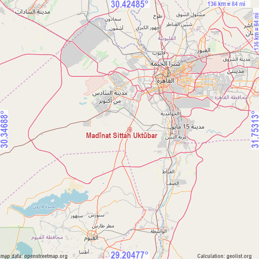
Madīnat Sittah Uktūbar GPS coordinates[2]
29° 49' 0.012" North, 31° 3' 0" East
| Map corner | latitude | longitude |
|---|---|---|
| Upper-left | 30.42485°, | 30.34688° |
| Center: | 29.81667°, | 31.05° |
| Lower-right: | 29.20477°, | 31.75313° |
| Map W x H: | 135.7×135.7 km | = 84.3×84.3mi |
| max Lat: | 31.5084° ⇑55.8% North |
| Madīnat Sittah Uktūbar: | 29.81667° |
| min Lat: | ⇓44.2% South 22.3457° |
| min Long | Madīnat Sittah | max Long |
| 25.51965° | 31.05° | 34.89572° |
| W 34.1%⇐ | ⇒65.9% E |
Elevation
Elevation of Madīnat Sittah Uktūbar is 126 m = 413 ft, and this is 82.5 m = 271 ft above average elevation for this country.
| Max E: |
1565 m = 5135 ft | 2.9% |
| Madīnat Sittah Uktūbar | 126 m 413 ft | |
| Avg. | 43.5 m = 143 ft | |
Min E: |
-15 m = -49 ft | 97.1% |
See also: Madīnat Sittah Uktūbar elevation on elevation.city.
Geographical zone
Madīnat Sittah Uktūbar is located in North temperate zone (between Tropic of Cancer and the Arctic Circle). Distance of this Northern Tropic circle is 709.4 km =440.8 mi to South.| Distance of | km | miles | from Madīnat Sittah Uktūbar |
|---|---|---|---|
| North Pole | 6691.8 | 4158.1 | to North |
| Arctic Circle | 4085.9 | 2538.9 | to North |
| Tropic Cancer | 709.4 | 440.8 | to South |
| Equator | 3315.3 | 2060 | to South |


Nearby cities:
15 places around Madīnat Sittah Uktūbar: (largest is in red/bold)
• Al Fayyūm
59.8 km =37.2 mi,  199°
199°
• Al Khānkah
53.4 km =33.2 mi,  34°
34°
• Al Qanāţir al Khayrīyah
42.7 km =26.5 mi,  11°
11°
• Al Wāsiţah
55.3 km =34.4 mi,  164°
164°
• Al Ḩawāmidīyah
21.4 km =13.3 mi,  64°
64°
• Al ‘Ayyāţ
29.7 km =18.5 mi,  137°
137°
• Ashmūn
53.9 km =33.5 mi,  352°
352°
• Awsīm
35.1 km =21.8 mi, 13°
• Aş Şaff
35.8 km =22.2 mi, 141°
• Cairo
33.4 km =20.8 mi,  35°
35°
• Giza
26.3 km =16.3 mi, 36°
• New Cairo
46.9 km =29.1 mi, 59°
• Qalyūb
43 km =26.7 mi,  20°
20°
• Ţāmiyah
38.8 km =24.1 mi,  192°
192°
• Ḩalwān
24.4 km =15.2 mi,  83°
83°
Sources, notices
• [Note1] Compared only with cities in Egypt existing in our database
• [Src1] Map data: © OpenStreetMap contributors (CC-BY-SA)
• [Src2] Other city data from geonames.org with taken over terms of usage.
• [Src3] Geographical zone / Annual Mean Temperature by Robert A. Rohde @ Wikipedia
