Zufre geodata
Zufre (Andalusia) is a seat of a third-order administrative division; located in Spain in Europe/Madrid (GMT+2) time zone. In our database, there are 6762 cities with bigger population. Compared to other cities in Spain, 89.5% of cities are located further ↑North; 89.7% of cities are located further →East and 71.3% of cities have higher elevation than Zufre. Note1


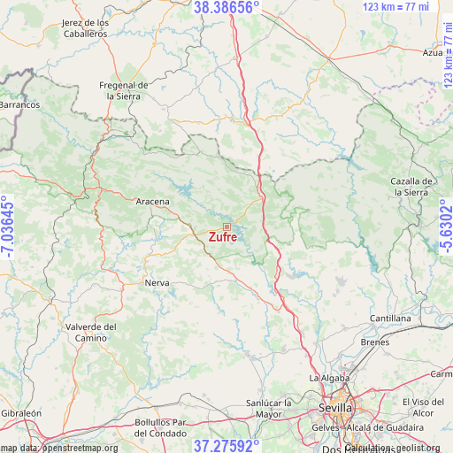
Zufre GPS coordinates[2]
37° 49' 59.988" North, 6° 19' 59.988" West
| Map corner | latitude | longitude |
|---|---|---|
| Upper-left | 38.38656°, | -7.03645° |
| Center: | 37.83333°, | -6.33333° |
| Lower-right: | 37.27592°, | -5.6302° |
| Map W x H: | 123.5×123.5 km | = 76.7×76.7mi |
| max Lat: | 43.74134° ⇑89.5% North |
| Zufre: | 37.83333° |
| min Lat: | ⇓10.5% South 27.64134° |
| min Long | Zufre | max Long |
| -18.00367° | -6.33333° | 4.2899° |
| W 10.3%⇐ | ⇒89.7% E |
Elevation
Elevation of Zufre is 361 m = 1184 ft, and this is 237 m = 778 ft below average elevation for this country.
| Max E: |
1682 m = 5518 ft | 71.3% |
| Avg. | 598 m = 1962 ft | |
| Zufre | 361 m = 1184 ft | |
Min E: |
0 m = 0 ft | 28.7% |
See also: Spain elevation on elevation.city.
Geographical zone
Zufre is located in North temperate zone (between Tropic of Cancer and the Arctic Circle). Distance of this Northern Tropic circle is 1600.8 km =994.7 mi to South.| Distance of | km | miles | from Zufre |
|---|---|---|---|
| North Pole | 5800.4 | 3604.2 | to North |
| Arctic Circle | 3194.5 | 1985 | to North |
| Tropic Cancer | 1600.8 | 994.7 | to South |
| Equator | 4206.7 | 2613.9 | to South |


Nearby cities:
15 places around Zufre: (largest is in red/bold)
• Almadén de la Plata
22.6 km =14 mi,  78°
78°
• Aracena
21.1 km =13.1 mi,  288°
288°
• Arroyomolinos de León
21.7 km =13.5 mi,  340°
340°
• Cala
14.9 km =9.3 mi,  5°
5°
• Campofrío
22.4 km =13.9 mi,  250°
250°
• Cañaveral de León
26 km =16.2 mi,  321°
321°
• Corteconcepción
16.4 km =10.2 mi,  296°
296°
• Cortelazor
28 km =17.4 mi, 294°
• El Castillo de las Guardas
15.7 km =9.8 mi,  174°
174°
• El Garrobo
27 km =16.8 mi,  148°
148°
• El Ronquillo
18.2 km =11.3 mi,  130°
130°
• Higuera de la Sierra
10.2 km =6.3 mi,  270°
270°
• Linares de la Sierra
26 km =16.2 mi,  281°
281°
• Nerva
24.4 km =15.2 mi,  231°
231°
• Santa Olalla del Cala
12.6 km =7.8 mi,  54°
54°
Sources, notices
• [Note1] Compared only with cities in Spain existing in our database
• [Src1] Map data: © OpenStreetMap contributors (CC-BY-SA)
• [Src2] Other city data from geonames.org with taken over terms of usage.
• [Src3] Geographical zone / Annual Mean Temperature by Robert A. Rohde @ Wikipedia
