Nerva geodata
Nerva (Andalusia) is a seat of a third-order administrative division; located in Spain in Europe/Madrid (GMT+2) time zone. With population of 6,009 people, there are 1137 cities with bigger population in this country. Compared to other cities in Spain, 90.1% of cities are located further ↑North; 91.6% of cities are located further →East and 72.8% of cities have higher elevation than Nerva. Note1


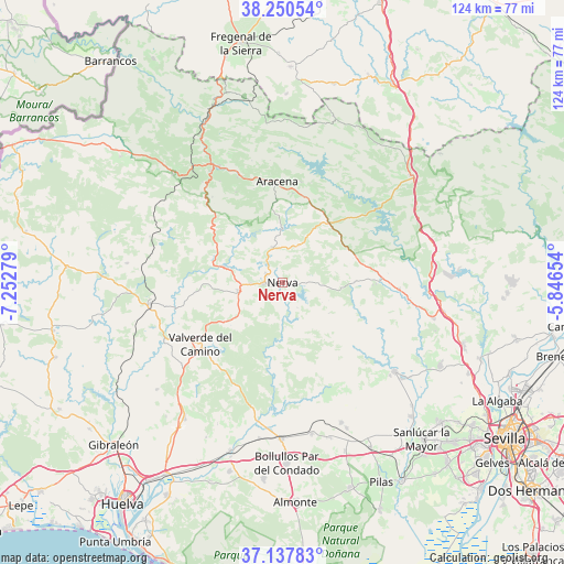
Nerva GPS coordinates[2]
37° 41' 46.572" North, 6° 32' 58.812" West
| Map corner | latitude | longitude |
|---|---|---|
| Upper-left | 38.25054°, | -7.25279° |
| Center: | 37.69627°, | -6.54967° |
| Lower-right: | 37.13783°, | -5.84654° |
| Map W x H: | 123.7×123.7 km | = 76.9×76.9mi |
| max Lat: | 43.74134° ⇑90.1% North |
| Nerva: | 37.69627° |
| min Lat: | ⇓9.9% South 27.64134° |
| min Long | Nerva | max Long |
| -18.00367° | -6.54967° | 4.2899° |
| W 8.4%⇐ | ⇒91.6% E |
Elevation
Elevation of Nerva is 336 m = 1102 ft, and this is 262 m = 860 ft below average elevation for this country.
| Max E: |
1682 m = 5518 ft | 72.8% |
| Avg. | 598 m = 1962 ft | |
| Nerva | 336 m = 1102 ft | |
Min E: |
0 m = 0 ft | 27.2% |
See also: Spain elevation on elevation.city.
Geographical zone
Nerva is located in North temperate zone (between Tropic of Cancer and the Arctic Circle). Distance of this Northern Tropic circle is 1585.5 km =985.2 mi to South.| Distance of | km | miles | from Nerva |
|---|---|---|---|
| North Pole | 5815.6 | 3613.6 | to North |
| Arctic Circle | 3209.7 | 1994.4 | to North |
| Tropic Cancer | 1585.5 | 985.2 | to South |
| Equator | 4191.4 | 2604.4 | to South |


Nearby cities:
15 places around Nerva: (largest is in red/bold)
• Alájar
22.2 km =13.8 mi,  332°
332°
• Aracena
22 km =13.7 mi,  357°
357°
• Berrocal
9.8 km =6.1 mi,  175°
175°
• Campofrío
8.1 km =5 mi,  344°
344°
• Corteconcepción
23.1 km =14.4 mi,  10°
10°
• Cortelazor
27.5 km =17.1 mi,  346°
346°
• El Castillo de las Guardas
20.6 km =12.8 mi,  90°
90°
• Fuenteheridos
25.2 km =15.7 mi, 337°
• Higuera de la Sierra
17.6 km =10.9 mi,  29°
29°
• Jabugo
29.1 km =18.1 mi, 327°
• Linares de la Sierra
21.4 km =13.3 mi, 342°
• Santa Ana la Real
24 km =14.9 mi,  320°
320°
• Valverde del Camino
22.5 km =14 mi,  233°
233°
• Zalamea la Real
9.9 km =6.2 mi,  259°
259°
• Zufre
24.4 km =15.2 mi,  51°
51°
Sources, notices
• [Note1] Compared only with cities in Spain existing in our database
• [Src1] Map data: © OpenStreetMap contributors (CC-BY-SA)
• [Src2] Other city data from geonames.org with taken over terms of usage.
• [Src3] Geographical zone / Annual Mean Temperature by Robert A. Rohde @ Wikipedia
