Tuineje geodata
Tuineje (Canary Islands) is a seat of a third-order administrative division; located in Spain in Atlantic/Canary (GMT+1) time zone. With population of 13,632 people, there are 679 cities with bigger population in this country. Compared to other cities in Spain, 99.2% of cities are located further ↑North; 98.7% of cities are located further →East and 82% of cities have higher elevation than Tuineje. Note1
Administrative division(s):
- Level 1: Canary Islands
- Level 2: Provincia de Las Palmas
- Level 3: Tuineje


Tuineje GPS coordinates[2]
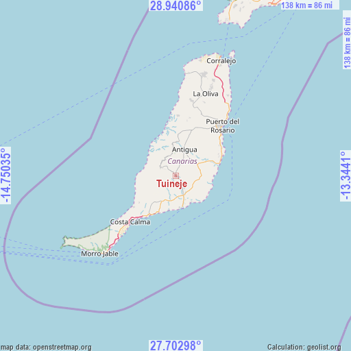
28° 19' 25.392" North, 14° 2' 49.992" West
| Map corner | latitude | longitude |
|---|---|---|
| Upper-left | 28.94086°, | -14.75035° |
| Center: | 28.32372°, | -14.04722° |
| Lower-right: | 27.70298°, | -13.3441° |
| Map W x H: | 137.6×137.6 km | = 85.5×85.5mi |
| max Lat: | 43.74134° ⇑99.2% North |
| Tuineje: | 28.32372° |
| min Lat: | ⇓0.8% South 27.64134° |
| min Long | Tuineje | max Long |
| -18.00367° | -14.04722° | 4.2899° |
| W 1.3%⇐ | ⇒98.7% E |
Elevation
Elevation of Tuineje is 185 m = 607 ft, and this is 413 m = 1355 ft below average elevation for this country.
| Max E: |
1682 m = 5518 ft | 82% |
| Avg. | 598 m = 1962 ft | |
| Tuineje | 185 m = 607 ft | |
Min E: |
0 m = 0 ft | 18% |
See also: Spain elevation on elevation.city.
Geographical zone
Tuineje is located in North temperate zone (between Tropic of Cancer and the Arctic Circle). Distance of this Northern Tropic circle is 543.4 km =337.7 mi to South.| Distance of | km | miles | from Tuineje |
|---|---|---|---|
| North Pole | 6857.8 | 4261.2 | to North |
| Arctic Circle | 4251.9 | 2642 | to North |
| Tropic Cancer | 543.4 | 337.7 | to South |
| Equator | 3149.3 | 1956.9 | to South |


Nearby cities:
15 places around Tuineje: (largest is in red/bold)
• Antigua
11.5 km =7.1 mi,  16°
16°
• Arrecife
86.2 km =53.6 mi,  34°
34°
• Betancuría
11.1 km =6.9 mi,  355°
355°
• Corralejo
48.5 km =30.1 mi, 21°
• Costa Calma
25.2 km =15.7 mi,  224°
224°
• El Cotillo
40.1 km =24.9 mi,  5°
5°
• La Oliva
33.9 km =21.1 mi, 19°
• Mácher
77.7 km =48.3 mi, 26°
• Playa Blanca
63.8 km =39.6 mi, 19°
• Puerto del Carmen
76.3 km =47.4 mi, 29°
• Puerto del Rosario
26.7 km =16.6 mi,  42°
42°
• Pájara
6.6 km =4.1 mi,  296°
296°
• Tías
81 km =50.3 mi, 28°
• Uga
75.7 km =47 mi, 22°
• Yaiza
75.6 km =47 mi, 21°
Sources, notices
• [Note1] Compared only with cities in Spain existing in our database
• [Src1] Map data: © OpenStreetMap contributors (CC-BY-SA)
• [Src2] Other city data from geonames.org with taken over terms of usage.
• [Src3] Geographical zone / Annual Mean Temperature by Robert A. Rohde @ Wikipedia
