Torreorgaz geodata
Torreorgaz (Extremadura) is a seat of a third-order administrative division; located in Spain in Europe/Madrid (GMT+2) time zone. With population of 1,683 people, there are 2350 cities with bigger population in this country. Compared to other cities in Spain, 78% of cities are located further ↑North; 88.9% of cities are located further →East and 67.4% of cities have higher elevation than Torreorgaz. Note1


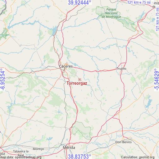
Torreorgaz GPS coordinates[2]
39° 22' 59.16" North, 6° 14' 57.876" West
| Map corner | latitude | longitude |
|---|---|---|
| Upper-left | 39.92444°, | -6.95254° |
| Center: | 39.3831°, | -6.24941° |
| Lower-right: | 38.83753°, | -5.54629° |
| Map W x H: | 120.9×120.9 km | = 75.1×75.1mi |
| max Lat: | 43.74134° ⇑78% North |
| Torreorgaz: | 39.3831° |
| min Lat: | ⇓22% South 27.64134° |
| min Long | Torreorgaz | max Long |
| -18.00367° | -6.24941° | 4.2899° |
| W 11.1%⇐ | ⇒88.9% E |
Elevation
Elevation of Torreorgaz is 427 m = 1401 ft, and this is 171 m = 561 ft below average elevation for this country.
| Max E: |
1682 m = 5518 ft | 67.4% |
| Avg. | 598 m = 1962 ft | |
| Torreorgaz | 427 m = 1401 ft | |
Min E: |
0 m = 0 ft | 32.6% |
See also: Spain elevation on elevation.city.
Geographical zone
Torreorgaz is located in North temperate zone (between Tropic of Cancer and the Arctic Circle). Distance of this Northern Tropic circle is 1773.1 km =1101.8 mi to South.| Distance of | km | miles | from Torreorgaz |
|---|---|---|---|
| North Pole | 5628.1 | 3497.1 | to North |
| Arctic Circle | 3022.2 | 1877.9 | to North |
| Tropic Cancer | 1773.1 | 1101.8 | to South |
| Equator | 4379 | 2721 | to South |


Nearby cities:
15 places around Torreorgaz: (largest is in red/bold)
• Albalá
15.2 km =9.4 mi,  158°
158°
• Aldea del Cano
12 km =7.5 mi,  209°
209°
• Benquerencia
16.3 km =10.1 mi,  119°
119°
• Botija
15.7 km =9.8 mi,  105°
105°
• Casas de Don Antonio
16.8 km =10.4 mi,  192°
192°
• Cáceres
14.8 km =9.2 mi,  314°
314°
• Montánchez
19.5 km =12.1 mi,  153°
153°
• Plasenzuela
17.3 km =10.7 mi,  90°
90°
• Santa Marta de Magasca
19.3 km =12 mi,  42°
42°
• Sierra de Fuentes
6.6 km =4.1 mi,  342°
342°
• Torre de Santa María
18.3 km =11.4 mi,  141°
141°
• Torremocha
7.8 km =4.8 mi, 122°
• Torrequemada
3.1 km =1.9 mi,  126°
126°
• Valdefuentes
16.3 km =10.1 mi, 137°
• Valdesalor
8.5 km =5.3 mi,  266°
266°
Sources, notices
• [Note1] Compared only with cities in Spain existing in our database
• [Src1] Map data: © OpenStreetMap contributors (CC-BY-SA)
• [Src2] Other city data from geonames.org with taken over terms of usage.
• [Src3] Geographical zone / Annual Mean Temperature by Robert A. Rohde @ Wikipedia
