Siete Aguas geodata
Siete Aguas (Valencia) is a seat of a third-order administrative division; located in Spain in Europe/Madrid (GMT+2) time zone. With population of 1,232 people, there are 2702 cities with bigger population in this country. Compared to other cities in Spain, 77.2% of cities are located further ↑North; 77.8% of cities are located further ←West and 52.9% of cities have lower elevation than Siete Aguas. Note1


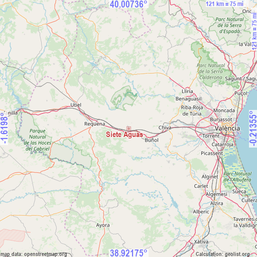
Siete Aguas GPS coordinates[2]
39° 28' 0.012" North, 0° 55' 0.012" West
| Map corner | latitude | longitude |
|---|---|---|
| Upper-left | 40.00736°, | -1.6198° |
| Center: | 39.46667°, | -0.91667° |
| Lower-right: | 38.92175°, | -0.21355° |
| Map W x H: | 120.7×120.7 km | = 75×75mi |
| max Lat: | 43.74134° ⇑77.2% North |
| Siete Aguas: | 39.46667° |
| min Lat: | ⇓22.8% South 27.64134° |
| min Long | Siete Aguas | max Long |
| -18.00367° | -0.91667° | 4.2899° |
| W 77.8%⇐ | ⇒22.2% E |
Elevation
Elevation of Siete Aguas is 689 m = 2260 ft, and this is 91 m = 299 ft above average elevation for this country.
| Max E: |
1682 m = 5518 ft | 47.1% |
| Siete Aguas | 689 m 2260 ft | |
| Avg. | 598 m = 1962 ft | |
Min E: |
0 m = 0 ft | 52.9% |
See also: Spain elevation on elevation.city.
Geographical zone
Siete Aguas is located in North temperate zone (between Tropic of Cancer and the Arctic Circle). Distance of this Northern Tropic circle is 1782.4 km =1107.5 mi to South.| Distance of | km | miles | from Siete Aguas |
|---|---|---|---|
| North Pole | 5618.8 | 3491.4 | to North |
| Arctic Circle | 3012.9 | 1872.1 | to North |
| Tropic Cancer | 1782.4 | 1107.5 | to South |
| Equator | 4388.3 | 2726.8 | to South |


Nearby cities:
15 places around Siete Aguas: (largest is in red/bold)
• Alborache
15.9 km =9.9 mi,  125°
125°
• Bugarra
21.1 km =13.1 mi,  37°
37°
• Buñol
12.7 km =7.9 mi,  115°
115°
• Chera
15.4 km =9.6 mi,  343°
343°
• Cheste
20.1 km =12.5 mi,  84°
84°
• Chiva
17.2 km =10.7 mi,  90°
90°
• Chulilla
20.6 km =12.8 mi,  7°
7°
• Gestalgar
16.5 km =10.3 mi,  25°
25°
• Godelleta
20.8 km =12.9 mi,  105°
105°
• Macastre
14.7 km =9.1 mi, 128°
• Pedralba
22.7 km =14.1 mi,  49°
49°
• Requena
16 km =9.9 mi,  278°
278°
• Sot de Chera
18.6 km =11.6 mi,  4°
4°
• Turís
20.8 km =12.9 mi, 116°
• Yátova
13.6 km =8.5 mi, 132°
Sources, notices
• [Note1] Compared only with cities in Spain existing in our database
• [Src1] Map data: © OpenStreetMap contributors (CC-BY-SA)
• [Src2] Other city data from geonames.org with taken over terms of usage.
• [Src3] Geographical zone / Annual Mean Temperature by Robert A. Rohde @ Wikipedia
